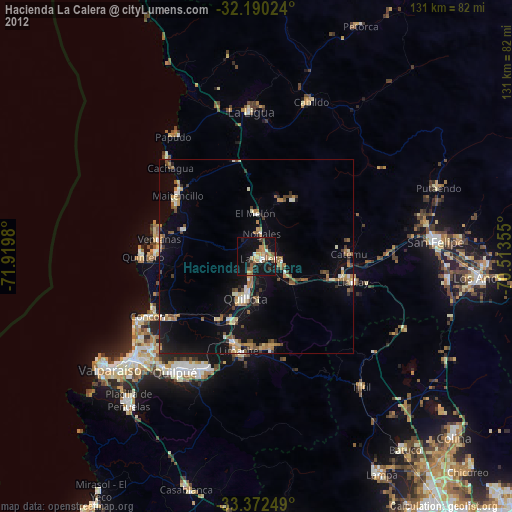
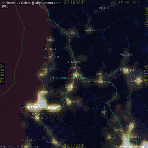
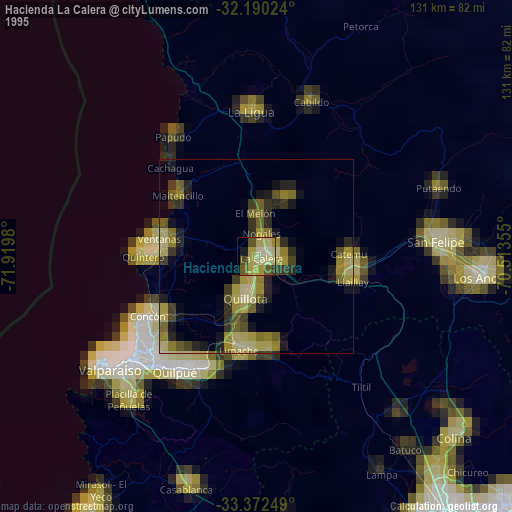
Hacienda La Calera night lights from space
Night Light of Hacienda La Calera (Valparaíso) from space (Chile) Src. Average luminocity for 10x10km area is 23.3969% and for 50x50km: 7.9256%.

Analysis of Hacienda La Calera night lights 2016
Square area 10x10 km:
 0.7%
0.7%90-99
2.27%80-89
3.67%70-79
3.15%60-69
4.9%50-59
3.67%40-49
1.92%30-39
5.24%20-29
4.37%10-19
34.97%0-9
35.14%Square area 50x50 km:
0.24%90-99
0.43%80-89
1.13%70-79
0.88%60-69
1.42%50-59
2%40-49
1.04%30-39
1.39%20-29
1.56%10-19
8.54%0-9
81.37%Clear (daylight) street map image can be seen on geolist.org.
Map coordinates:
32° 11' 24.9" South, 71° 55' 11.3" West
32° 46' 60" South, 71° 13' 0" West
33° 22' 21" South, 70° 30' 48.8" West
Some cities around Hacienda La Calera sort by population:
• Viña del Mar
41.2 km =25.6 mi,  229°
229°
• Quilpué
36.2 km =22.5 mi,  215°
215°
• Villa Alemana
32.3 km =20.1 mi,  206°
206°
• Quillota
11.5 km =7.1 mi,  195°
195°
• San Felipe
46 km =28.6 mi,  85°
85°
• Limache
26.4 km =16.4 mi,  190°
190°
• La Ligua
36.8 km =22.9 mi,  357°
357°
• Llaillay
25.2 km =15.7 mi,  104°
104°
3888214 (p: 49,106)
Sources (retrieved 2019-11-25):
» NASA, Earths city lights 1995
» NASA city lights 2003
» Earth at Night: Flat Maps 2012, 2016