Llaillay night lights from space
Night Light of Llaillay (Valparaíso) from space (Chile) Src. Average luminocity for 10x10km area is 18.0909% and for 50x50km: 6.5282%.
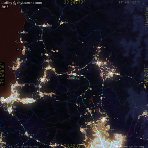
Analysis of Llaillay night lights 2016
Square area 10x10 km:
 0.17%
0.17%90-99
0.52%80-89
3.85%70-79
2.1%60-69
5.24%50-59
3.15%40-49
2.8%30-39
1.75%20-29
1.4%10-19
11.36%0-9
67.66%Square area 50x50 km:
0.24%90-99
0.35%80-89
0.73%70-79
0.72%60-69
1.31%50-59
1.58%40-49
1.1%30-39
1.53%20-29
1.14%10-19
5.14%0-9
86.17%Clear (daylight) street map image can be seen on geolist.org.
Map coordinates:
32° 14' 51.8" South, 71° 39' 33.7" West
32° 50' 25.5" South, 70° 57' 22.4" West
33° 25' 45.2" South, 70° 15' 11.2" West
Some cities around Llaillay sort by population:
• Villa Alemana
44.9 km =27.9 mi,  240°
240°
• Quillota
27.7 km =17.2 mi,  260°
260°
• San Felipe
23.8 km =14.8 mi,  64°
64°
• Los Andes
33.5 km =20.8 mi,  88°
88°
• Hacienda La Calera
25.2 km =15.7 mi,  284°
284°
• Limache
35 km =21.7 mi, 235°
• Lampa
50.1 km =31.1 mi,  171°
171°
• La Ligua
50.2 km =31.2 mi,  329°
329°
3883035 (p: 16,646)
Sources (retrieved 2019-11-25):
» Earth at Night: Flat Maps 2012, 2016