Issia night lights from space
Night Light of Issia (Sassandra-Marahoué) from space (Ivory Coast) Src. Average luminocity for 10x10km area is 9.6883% and for 50x50km: 0.6507%.
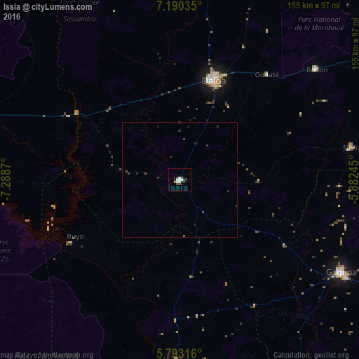
Analysis of Issia night lights 2016
Square area 10x10 km:
 0.87%
0.87%90-99
3.68%80-89
0.65%70-79
0%60-69
0.87%50-59
0.87%40-49
2.6%30-39
1.3%20-29
0.43%10-19
1.73%0-9
87.01%Square area 50x50 km:
0.03%90-99
0.15%80-89
0.03%70-79
0%60-69
0.03%50-59
0.11%40-49
0.22%30-39
0.23%20-29
0.2%10-19
0.17%0-9
98.82%Clear (daylight) street map image can be seen on geolist.org.
Map coordinates:
7° 11' 25.3" North, 7° 17' 19.3" West
6° 29' 32.1" North, 6° 35' 8.1" West
5° 47' 35.4" North, 5° 52' 56.8" West
Some cities around Issia sort by population:
• Daloa
45.4 km =28.2 mi,  19°
19°
• Gagnoa
80.8 km =50.2 mi,  119°
119°
• Bouaflé
108.2 km =67.2 mi,  59°
59°
• Sinfra
75.8 km =47.1 mi,  79°
79°
• Duekoué
88.8 km =55.2 mi,  288°
288°
• Guiglo
100.5 km =62.4 mi,  273°
273°
• Vavoua
99.6 km =61.9 mi,  6°
6°
• Guibéroua
53.7 km =33.4 mi, 121°
2287790 (p: 50,313)
Sources (retrieved 2019-11-25):
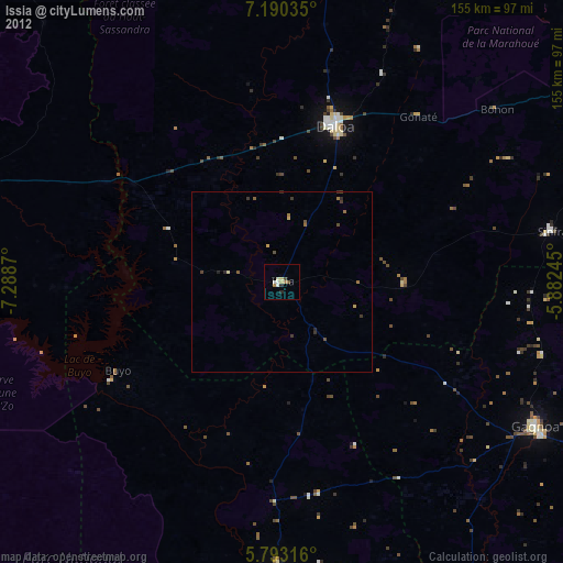
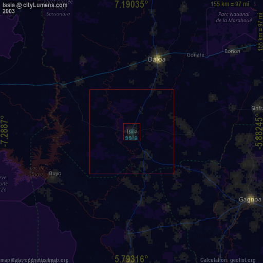
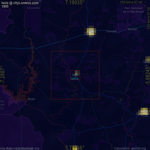
» NASA, Earths city lights 1995
» NASA city lights 2003
» Earth at Night: Flat Maps 2012, 2016