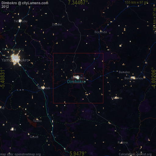
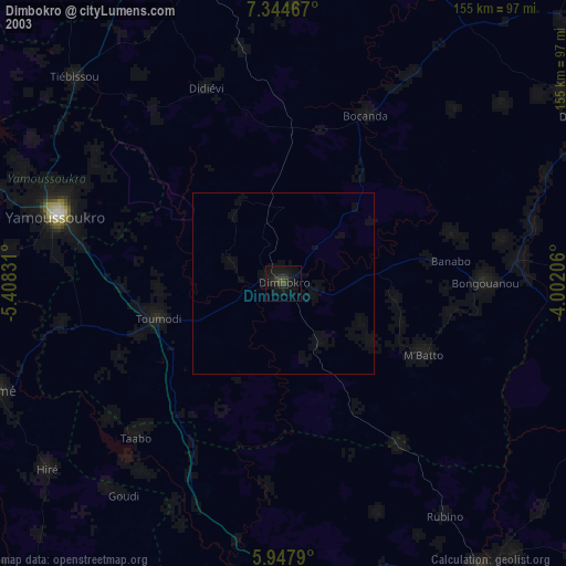
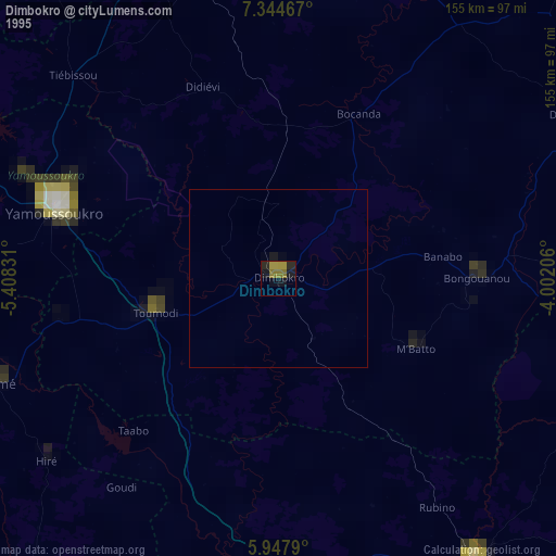
Dimbokro night lights from space
Night Light of Dimbokro (Lacs) from space (Ivory Coast) Src. Average luminocity for 10x10km area is 19.4957% and for 50x50km: 1.2325%.

Analysis of Dimbokro night lights 2016
Square area 10x10 km:
 1.95%
1.95%90-99
6.06%80-89
2.6%70-79
0.65%60-69
2.16%50-59
3.03%40-49
1.73%30-39
0%20-29
3.46%10-19
6.71%0-9
71.65%Square area 50x50 km:
0.08%90-99
0.24%80-89
0.1%70-79
0.03%60-69
0.22%50-59
0.27%40-49
0.25%30-39
0.23%20-29
0.17%10-19
0.37%0-9
98.04%Clear (daylight) street map image can be seen on geolist.org.
Map coordinates:
7° 20' 40.8" North, 5° 24' 29.9" West
6° 38' 48.4" North, 4° 42' 18.7" West
5° 56' 52.4" North, 4° 0' 7.4" West
Some cities around Dimbokro sort by population:
• Yamoussoukro
66 km =41 mi,  287°
287°
• Oumé
84 km =52.2 mi,  249°
249°
• Toumodi
35.9 km =22.3 mi, 254°
• Arrah
81.3 km =50.5 mi,  87°
87°
• Tiassalé
84.2 km =52.3 mi,  188°
188°
• Bongouanou
55.3 km =34.4 mi, 89°
• Affery
90.7 km =56.4 mi,  113°
113°
• Bocanda
51.5 km =32 mi,  26°
26°
2289983 (p: 67,349)
Sources (retrieved 2019-11-25):
» NASA, Earths city lights 1995
» NASA city lights 2003
» Earth at Night: Flat Maps 2012, 2016