Abengourou night lights from space
Night Light of Abengourou (Comoé) from space (Ivory Coast) Src. Average luminocity for 10x10km area is 30.6645% and for 50x50km: 1.758%.
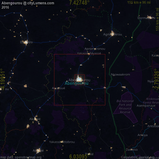
Analysis of Abengourou night lights 2016
Square area 10x10 km:
 5.63%
5.63%90-99
9.31%80-89
1.73%70-79
2.81%60-69
2.16%50-59
1.73%40-49
3.9%30-39
3.46%20-29
3.25%10-19
35.06%0-9
30.95%Square area 50x50 km:
0.22%90-99
0.4%80-89
0.11%70-79
0.15%60-69
0.15%50-59
0.12%40-49
0.27%30-39
0.35%20-29
0.29%10-19
1.58%0-9
96.36%Clear (daylight) street map image can be seen on geolist.org.
Map coordinates:
7° 25' 38.9" North, 4° 11' 58.2" West
6° 43' 47" North, 3° 29' 47" West
6° 1' 51.4" North, 2° 47' 35.7" West
Some cities around Abengourou sort by population:
• Adzopé
80.2 km =49.8 mi,  210°
210°
• Agnibilékrou
55.1 km =34.2 mi,  35°
35°
• Daoukro
63.2 km =39.3 mi,  305°
305°
• Arrah
52.6 km =32.7 mi,  263°
263°
• Akoupé
57.8 km =35.9 mi,  228°
228°
• Bongouanou
78.6 km =48.8 mi, 263°
• Affery
67.9 km =42.2 mi, 227°
• Bocanda
116.7 km =72.5 mi,  288°
288°
2293549 (p: 104,020)
Sources (retrieved 2019-11-25):
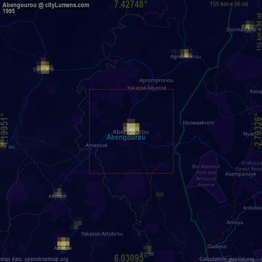
» NASA, Earths city lights 1995
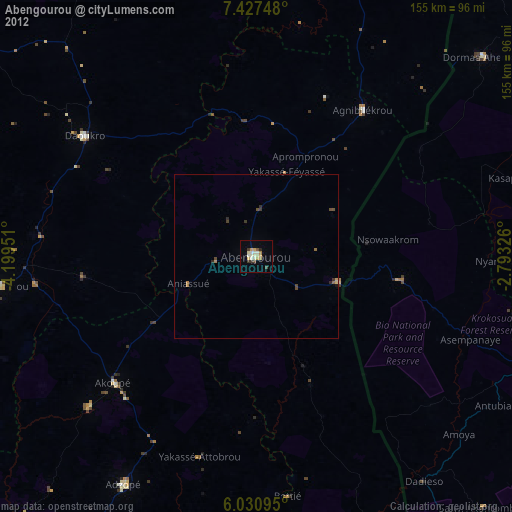
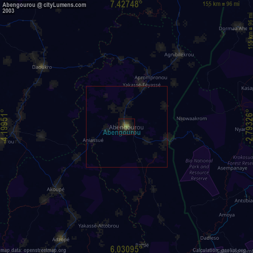
» NASA city lights 2003
» Earth at Night: Flat Maps 2012, 2016