Pully night lights from space
Night Light of Pully (Vaud) from space (Switzerland) Src. Average luminocity for 10x10km area is 41.5895% and for 50x50km: 12.0839%.
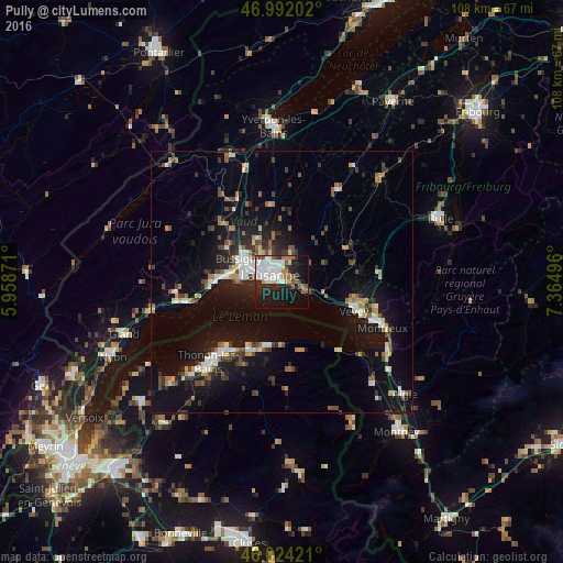
Analysis of Pully night lights 2016
Square area 10x10 km:
 10.94%
90-99
11.65%80-89
2.13%70-79
1.99%60-69
4.69%50-59
4.69%40-49
2.7%30-39
4.55%20-29
13.35%10-19
25%0-9
18.32%Square area 50x50 km:
1.47%90-99
1.97%80-89
0.88%70-79
1.16%60-69
1.44%50-59
1.39%40-49
1.91%30-39
1.83%20-29
3.11%10-19
10.64%0-9
74.19%Clear (daylight) street map image can be seen on geolist.org.
Map coordinates:
46° 59' 31.3" North, 5° 57' 31.4" East
46° 30' 37" North, 6° 39' 42.6" East
46° 1' 27.2" North, 7° 21' 53.9" East
Some cities around Pully sort by population:
• Lausanne
2.3 km =1.4 mi,  286°
286°
• Renens
6.5 km =4 mi,  300°
300°
• Prilly
5.3 km =3.3 mi, 304°
• Lutry
2.1 km =1.3 mi,  114°
114°
• Epalinges
4.3 km =2.7 mi,  6°
6°
• Blécherette
4.4 km =2.7 mi,  316°
316°
• Chavannes
7.3 km =4.5 mi, 287°
• Le Mont-sur-Lausanne
5.8 km =3.6 mi,  336°
336°
2659127 (p: 16,263)
Sources (retrieved 2019-11-25):
» Earth at Night: Flat Maps 2012, 2016