Epalinges night lights from space
Night Light of Epalinges (Vaud) from space (Switzerland) Src. Average luminocity for 10x10km area is 43.8068% and for 50x50km: 11.8521%.
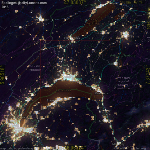
Analysis of Epalinges night lights 2016
Square area 10x10 km:
 10.23%
90-99
10.37%80-89
4.55%70-79
2.7%60-69
5.4%50-59
5.97%40-49
3.41%30-39
8.24%20-29
14.49%10-19
14.77%0-9
19.89%Square area 50x50 km:
1.47%90-99
1.95%80-89
0.87%70-79
1.15%60-69
1.41%50-59
1.38%40-49
1.84%30-39
1.84%20-29
3.12%10-19
9.8%0-9
75.17%Clear (daylight) street map image can be seen on geolist.org.
Map coordinates:
47° 1' 49.3" North, 5° 57' 54.6" East
46° 32' 56.3" North, 6° 40' 5.9" East
46° 3' 47.7" North, 7° 22' 17.1" East
Some cities around Epalinges sort by population:
• Lausanne
4.6 km =2.9 mi,  216°
216°
• Renens
6.2 km =3.9 mi,  260°
260°
• Pully
4.3 km =2.7 mi,  186°
186°
• Prilly
5.1 km =3.2 mi,  254°
254°
• Lutry
5.4 km =3.4 mi,  164°
164°
• Crissier
7.1 km =4.4 mi,  267°
267°
• Blécherette
3.7 km =2.3 mi, 253°
• Le Mont-sur-Lausanne
3 km =1.9 mi,  289°
289°
2660884 (p: 7,706)
Sources (retrieved 2019-11-25):
» Earth at Night: Flat Maps 2012, 2016