Le Mont-sur-Lausanne night lights from space
Night Light of Le Mont-sur-Lausanne (Vaud) from space (Switzerland) Src. Average luminocity for 10x10km area is 56.027% and for 50x50km: 12.207%.
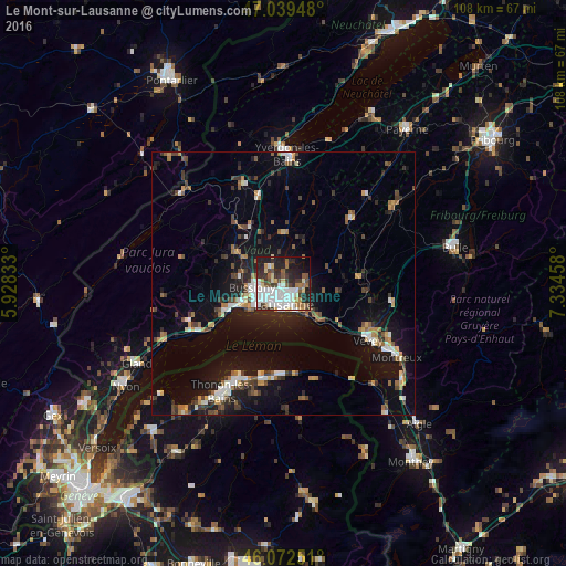
Analysis of Le Mont-sur-Lausanne night lights 2016
Square area 10x10 km:
 14.77%
90-99
16.05%80-89
5.26%70-79
2.56%60-69
6.68%50-59
6.53%40-49
4.26%30-39
9.66%20-29
16.62%10-19
13.78%0-9
3.84%Square area 50x50 km:
1.52%90-99
1.96%80-89
0.91%70-79
1.22%60-69
1.51%50-59
1.48%40-49
1.89%30-39
1.9%20-29
3.19%10-19
9.67%0-9
74.74%Clear (daylight) street map image can be seen on geolist.org.
Map coordinates:
47° 2' 22.1" North, 5° 55' 42" East
46° 33' 29.3" North, 6° 37' 53.2" East
46° 4' 21" North, 7° 20' 4.5" East
Some cities around Le Mont-sur-Lausanne sort by population:
• Lausanne
4.7 km =2.9 mi,  178°
178°
• Renens
3.9 km =2.4 mi,  238°
238°
• Pully
5.8 km =3.6 mi,  156°
156°
• Prilly
3.1 km =1.9 mi,  221°
221°
• Epalinges
3 km =1.9 mi,  109°
109°
• Crissier
4.5 km =2.8 mi,  252°
252°
• Blécherette
2.2 km =1.4 mi,  198°
198°
• Chavannes
5.6 km =3.5 mi, 236°
2659959 (p: 5,270)
Sources (retrieved 2019-11-25):
» Earth at Night: Flat Maps 2012, 2016