Blécherette night lights from space
Night Light of Blécherette (Vaud) from space (Switzerland) Src. Average luminocity for 10x10km area is 60.4403% and for 50x50km: 12.166%.
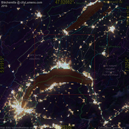
Analysis of Blécherette night lights 2016
Square area 10x10 km:
 16.9%
16.9%90-99
18.18%80-89
5.54%70-79
2.84%60-69
5.54%50-59
6.39%40-49
4.12%30-39
9.23%20-29
25.85%10-19
5.4%0-9
0%Square area 50x50 km:
1.45%90-99
1.92%80-89
0.93%70-79
1.21%60-69
1.46%50-59
1.43%40-49
1.86%30-39
1.96%20-29
3.23%10-19
10.38%0-9
74.17%Clear (daylight) street map image can be seen on geolist.org.
Map coordinates:
47° 1' 15" North, 5° 55' 8.9" East
46° 32' 21.6" North, 6° 37' 20.2" East
46° 3' 12.7" North, 7° 19' 31.4" East
Some cities around Blécherette sort by population:
• Lausanne
2.7 km =1.7 mi,  162°
162°
• Renens
2.6 km =1.6 mi,  271°
271°
• Pully
4.4 km =2.7 mi,  136°
136°
• Prilly
1.4 km =0.9 mi,  259°
259°
• Epalinges
3.7 km =2.3 mi,  73°
73°
• Crissier
3.6 km =2.2 mi,  281°
281°
• Chavannes
4.1 km =2.5 mi, 255°
• Le Mont-sur-Lausanne
2.2 km =1.4 mi,  18°
18°
8521688 (p: 6,516)
Sources (retrieved 2019-11-25):
» Earth at Night: Flat Maps 2012, 2016