Arbon night lights from space
Night Light of Arbon (Thurgau) from space (Switzerland) Src. Average luminocity for 10x10km area is 13.9063% and for 50x50km: 9.7197%.
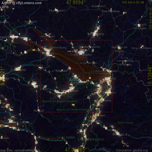
Analysis of Arbon night lights 2016
Square area 10x10 km:
 1.14%
1.14%90-99
1.7%80-89
2.84%70-79
0.28%60-69
0.71%50-59
1.56%40-49
4.26%30-39
1.7%20-29
1.28%10-19
12.07%0-9
72.44%Square area 50x50 km:
0.74%90-99
1.33%80-89
0.8%70-79
0.96%60-69
1.44%50-59
1.46%40-49
1.81%30-39
1.56%20-29
2.36%10-19
9.87%0-9
77.67%Clear (daylight) street map image can be seen on geolist.org.
Map coordinates:
47° 59' 21.8" North, 8° 43' 48.8" East
47° 31' 0" North, 9° 25' 60" East
47° 2' 22.7" North, 10° 8' 11.3" East
Some cities around Arbon sort by population:
• Sankt Gallen
11.2 km =7 mi,  203°
203°
• Amriswil
10.9 km =6.8 mi,  288°
288°
• Goldach
5.4 km =3.4 mi,  151°
151°
• Rorschach
6.1 km =3.8 mi,  135°
135°
• Romanshorn
6.8 km =4.2 mi,  323°
323°
• Wittenbach
7.1 km =4.4 mi,  209°
209°
• Langenargen, DE
12.2 km =7.6 mi,  41°
41°
• Thal
11.4 km =7.1 mi,  119°
119°
2661731 (p: 12,933)
Sources (retrieved 2019-11-25):
» Earth at Night: Flat Maps 2012, 2016