Romanshorn night lights from space
Night Light of Romanshorn (Thurgau) from space (Switzerland) Src. Average luminocity for 10x10km area is 4.358% and for 50x50km: 8.8631%.
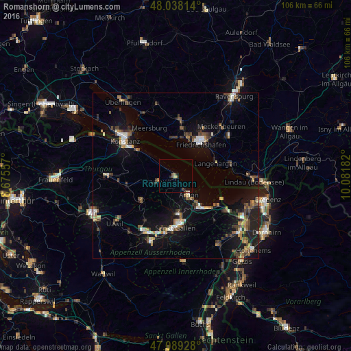
Analysis of Romanshorn night lights 2016
Square area 10x10 km:
 0.14%
0.14%90-99
0.14%80-89
0.85%70-79
0.57%60-69
0.57%50-59
0.99%40-49
0.99%30-39
0%20-29
0.99%10-19
0.71%0-9
94.03%Square area 50x50 km:
0.7%90-99
1.17%80-89
0.79%70-79
0.8%60-69
1.32%50-59
1.13%40-49
1.78%30-39
1.45%20-29
1.97%10-19
8.32%0-9
80.58%Clear (daylight) street map image can be seen on geolist.org.
Map coordinates:
48° 2' 17.3" North, 8° 40' 32.1" East
47° 33' 57.1" North, 9° 22' 43.3" East
47° 5' 21.4" North, 10° 4' 54.6" East
Some cities around Romanshorn sort by population:
• Friedrichshafen, DE
12.5 km =7.8 mi,  35°
35°
• Arbon
6.8 km =4.2 mi,  143°
143°
• Amriswil
6.6 km =4.1 mi,  251°
251°
• Goldach
12.2 km =7.6 mi,  146°
146°
• Rorschach
12.9 km =8 mi, 139°
• Wittenbach
11.7 km =7.3 mi,  177°
177°
• Langenargen, DE
12.8 km =8 mi,  73°
73°
• Immenstaad am Bodensee, DE
11.2 km =7 mi,  355°
355°
2658985 (p: 8,956)
Sources (retrieved 2019-11-25):
» Earth at Night: Flat Maps 2012, 2016