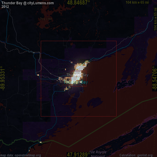
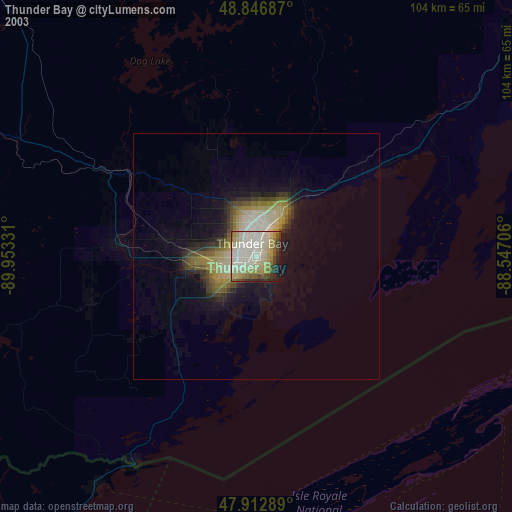
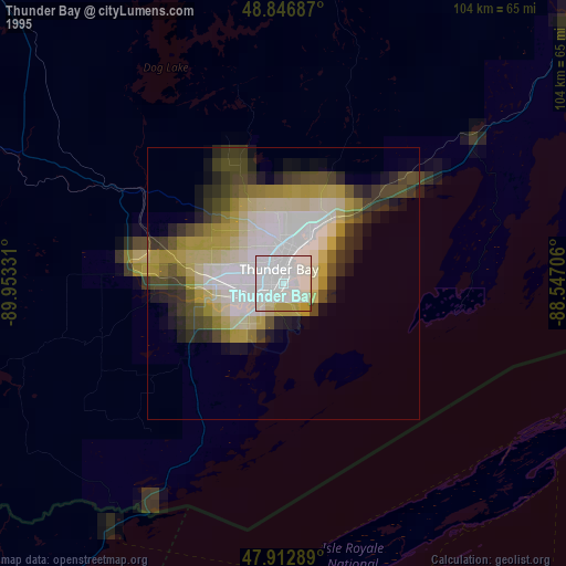
Thunder Bay night lights from space
Night Light of Thunder Bay (Ontario) from space (Canada) Src. Average luminocity for 10x10km area is 54.044% and for 50x50km: 4.6133%.

Analysis of Thunder Bay night lights 2016
Square area 10x10 km:
 18.89%
90-99
16.05%80-89
3.41%70-79
3.27%60-69
2.13%50-59
2.56%40-49
4.69%30-39
7.39%20-29
17.19%10-19
15.34%0-9
9.09%Square area 50x50 km:
1.02%90-99
1.13%80-89
0.21%70-79
0.3%60-69
0.26%50-59
0.42%40-49
0.66%30-39
0.8%20-29
1.65%10-19
3.21%0-9
90.35%Clear (daylight) street map image can be seen on geolist.org.
Map coordinates:
48° 50' 48.7" North, 89° 57' 11.9" West
48° 22' 55.3" North, 89° 15' 0.6" West
47° 54' 46.4" North, 88° 32' 49.4" West
Some cities around Thunder Bay sort by population:
• Duluth, US
278.3 km =172.9 mi,  230°
230°
• Marquette, US
247.4 km =153.7 mi,  145°
145°
• Virginia, US
262.7 km =163.2 mi,  248°
248°
• Ashland, US
233.8 km =145.3 mi,  211°
211°
• Houghton, US
149.1 km =92.6 mi,  160°
160°
• Ishpeming, US
241.8 km =150.2 mi, 150°
• Ironwood, US
225.2 km =139.9 mi,  197°
197°
• Iron River, US
258.6 km =160.7 mi,  169°
169°
6166142 (p: 99,334)
Sources (retrieved 2019-11-25):
» NASA, Earths city lights 1995
» NASA city lights 2003
» Earth at Night: Flat Maps 2012, 2016