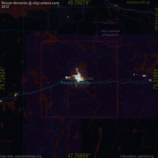
Rouyn-Noranda night lights from space
Night Light of Rouyn-Noranda (Quebec) from space (Canada) Src. Average luminocity for 10x10km area is 25.2098% and for 50x50km: 1.1605%.
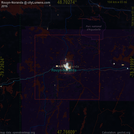
Analysis of Rouyn-Noranda night lights 2016
Square area 10x10 km:
 6.1%
6.1%90-99
6.99%80-89
0.6%70-79
1.19%60-69
0.74%50-59
3.42%40-49
1.93%30-39
1.04%20-29
3.27%10-19
32.89%0-9
41.82%Square area 50x50 km:
0.23%90-99
0.27%80-89
0.05%70-79
0.07%60-69
0.03%50-59
0.17%40-49
0.12%30-39
0.08%20-29
0.19%10-19
1.31%0-9
97.49%Clear (daylight) street map image can be seen on geolist.org.
Map coordinates:
48° 42' 9.9" North, 79° 43' 34.5" West
48° 14' 11.6" North, 79° 1' 23.2" West
47° 45' 57.9" North, 78° 19' 12" West
Some cities around Rouyn-Noranda sort by population:
• North Bay
216.1 km =134.3 mi,  188°
188°
• Timmins
172.6 km =107.2 mi,  278°
278°
• Val-d'Or
92.2 km =57.3 mi,  99°
99°
• Amos
76.4 km =47.5 mi,  61°
61°
• Valley East
229.2 km =142.4 mi,  220°
220°
• Temiskaming Shores
97.4 km =60.5 mi,  212°
212°
• Kirkland Lake
75.9 km =47.2 mi,  262°
262°
• La Sarre
64 km =39.8 mi,  348°
348°
6128577 (p: 23,504)
Sources (retrieved 2019-11-25):
» Earth at Night: Flat Maps 2012, 2016