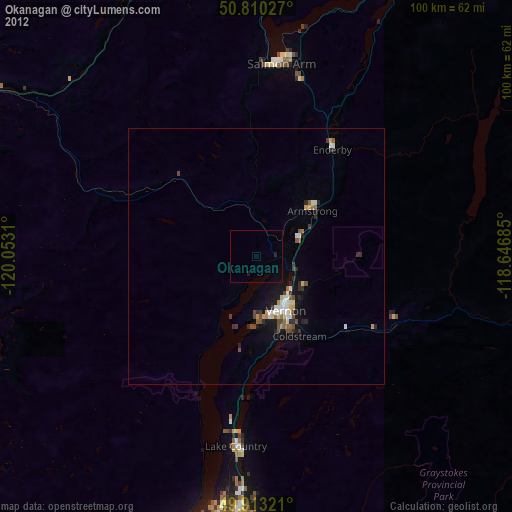
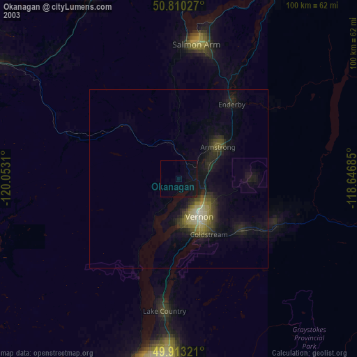
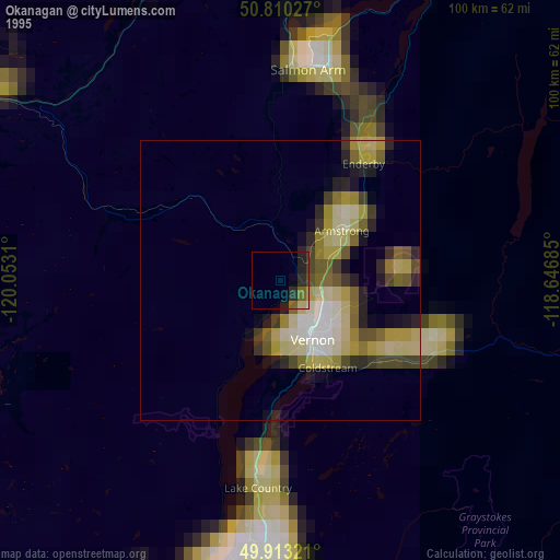
Okanagan night lights from space
Night Light of Okanagan (British Columbia) from space (Canada) Src. Average luminocity for 10x10km area is 0.3796% and for 50x50km: 1.9867%.
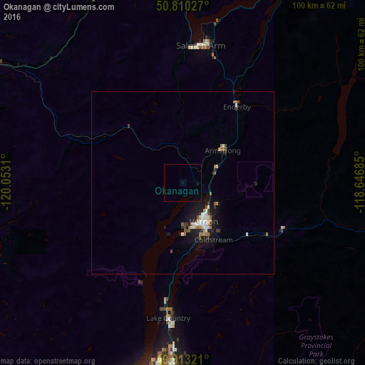
Analysis of Okanagan night lights 2016
Square area 10x10 km:
 0%
0%90-99
0%80-89
0%70-79
0%60-69
0%50-59
0%40-49
0%30-39
0%20-29
0%10-19
0.56%0-9
99.44%Square area 50x50 km:
0.31%90-99
0.34%80-89
0.09%70-79
0.16%60-69
0.33%50-59
0.31%40-49
0.19%30-39
0.27%20-29
0.36%10-19
1.94%0-9
95.69%Clear (daylight) street map image can be seen on geolist.org.
Map coordinates:
50° 48' 37" North, 120° 3' 11.2" West
50° 21' 49.9" North, 119° 20' 59.9" West
49° 54' 47.6" North, 118° 38' 48.7" West
Some cities around Okanagan sort by population:
• Kelowna
54.3 km =33.7 mi,  190°
190°
• Kamloops
76.3 km =47.4 mi,  296°
296°
• Vernon
12 km =7.5 mi,  153°
153°
• Penticton
99.6 km =61.9 mi, 189°
• West Kelowna
58.2 km =36.2 mi,  196°
196°
• Salmon Arm
37.5 km =23.3 mi,  5°
5°
• Duck Lake
39.6 km =24.6 mi,  184°
184°
• Summerland
88 km =54.7 mi, 195°
7281931 (p: 297,601)
Sources (retrieved 2019-11-25):
» NASA, Earths city lights 1995
» NASA city lights 2003
» Earth at Night: Flat Maps 2012, 2016