Salmon Arm night lights from space
Night Light of Salmon Arm (British Columbia) from space (Canada) Src. Average luminocity for 10x10km area is 11.9973% and for 50x50km: 0.8047%.
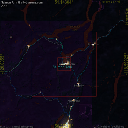
Analysis of Salmon Arm night lights 2016
Square area 10x10 km:
 1.2%
1.2%90-99
2.01%80-89
2.14%70-79
1.2%60-69
2.14%50-59
0.94%40-49
0.53%30-39
1.6%20-29
1.74%10-19
2.67%0-9
83.82%Square area 50x50 km:
0.08%90-99
0.12%80-89
0.09%70-79
0.06%60-69
0.14%50-59
0.16%40-49
0.14%30-39
0.11%20-29
0.08%10-19
0.21%0-9
98.82%Clear (daylight) street map image can be seen on geolist.org.
Map coordinates:
51° 8' 34.9" North, 120° 0' 19.8" West
50° 41' 59.3" North, 119° 18' 8.5" West
50° 15' 8.4" North, 118° 35' 57.3" West
Some cities around Salmon Arm sort by population:
• Okanagan
37.5 km =23.3 mi,  185°
185°
• Kelowna
91.7 km =57 mi, 188°
• Kamloops
71.7 km =44.6 mi,  267°
267°
• Vernon
48.1 km =29.9 mi,  177°
177°
• West Kelowna
95.2 km =59.2 mi, 192°
• Revelstoke
84.5 km =52.5 mi,  66°
66°
• Merritt
124.3 km =77.2 mi,  238°
238°
• Duck Lake
77.1 km =47.9 mi, 184°
6139416 (p: 12,875)
Sources (retrieved 2019-11-25):
» Earth at Night: Flat Maps 2012, 2016