Delta night lights from space
Night Light of Delta (British Columbia) from space (Canada) Src. Average luminocity for 10x10km area is 76.3025% and for 50x50km: 40.842%.
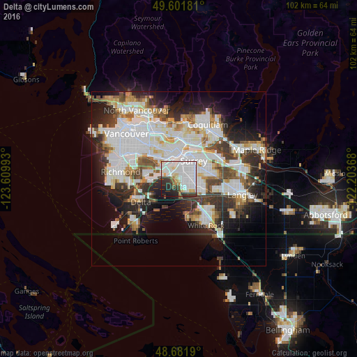

Analysis of Delta night lights 2016
Square area 10x10 km:
 37.25%
90-99
21.57%80-89
6.3%70-79
2.38%60-69
3.08%50-59
1.96%40-49
3.5%30-39
8.96%20-29
9.66%10-19
5.32%0-9
0%Square area 50x50 km:
13.67%90-99
10.47%80-89
3.51%70-79
3.37%60-69
2.92%50-59
3.67%40-49
3.94%30-39
5.24%20-29
7.98%10-19
10.68%0-9
34.54%Clear (daylight) street map image can be seen on geolist.org.
Map coordinates:
49° 36' 6.5" North, 123° 36' 35.7" West
49° 8' 38.4" North, 122° 54' 24.5" West
48° 40' 54.8" North, 122° 12' 13.2" West
Some cities around Delta sort by population:
• Surrey
7.3 km =4.5 mi,  125°
125°
• Burnaby
14 km =8.7 mi,  346°
346°
• Ladner
14.1 km =8.8 mi,  244°
244°
• Richmond
17 km =10.6 mi,  279°
279°
• White Rock
16.1 km =10 mi,  151°
151°
• New Westminster
7 km =4.3 mi,  357°
357°
• Port Coquitlam
16.9 km =10.5 mi,  36°
36°
• Port Moody
16.4 km =10.2 mi,  21°
21°
5937615 (p: 101,668)
Sources (retrieved 2019-11-25):
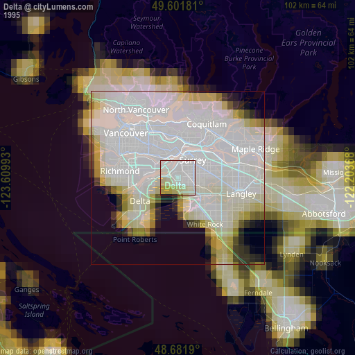
» NASA, Earths city lights 1995
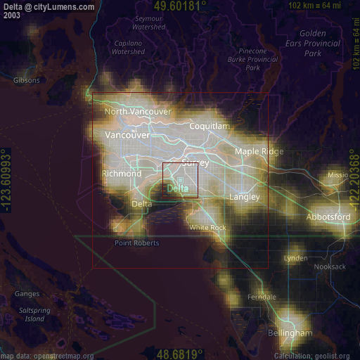
» NASA city lights 2003
» Earth at Night: Flat Maps 2012, 2016