Port Coquitlam night lights from space
Night Light of Port Coquitlam (British Columbia) from space (Canada) Src. Average luminocity for 10x10km area is 69.2179% and for 50x50km: 33.4096%.
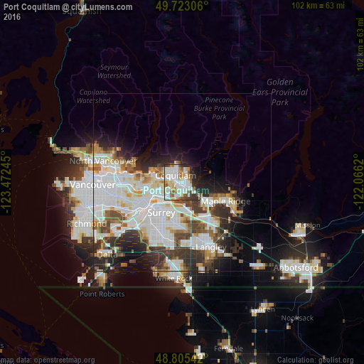
Analysis of Port Coquitlam night lights 2016
Square area 10x10 km:
 21.52%
90-99
23.13%80-89
6.55%70-79
7.49%60-69
4.28%50-59
6.02%40-49
5.35%30-39
6.55%20-29
9.89%10-19
6.95%0-9
2.27%Square area 50x50 km:
11.08%90-99
8.89%80-89
2.83%70-79
2.79%60-69
2.53%50-59
2.98%40-49
3.26%30-39
4.43%20-29
6.05%10-19
7.18%0-9
47.99%Clear (daylight) street map image can be seen on geolist.org.
Map coordinates:
49° 43' 23" North, 123° 28' 20.8" West
49° 15' 58.9" North, 122° 46' 9.6" West
48° 48' 19.5" North, 122° 3' 58.3" West
Some cities around Port Coquitlam sort by population:
• Surrey
18.2 km =11.3 mi,  192°
192°
• Burnaby
13.3 km =8.3 mi,  269°
269°
• Coquitlam
2.2 km =1.4 mi,  335°
335°
• Delta
16.9 km =10.5 mi,  216°
216°
• Maple Ridge
13.2 km =8.2 mi,  113°
113°
• New Westminster
12.2 km =7.6 mi,  237°
237°
• Walnut Grove
14.7 km =9.1 mi,  140°
140°
• Pitt Meadows
7.7 km =4.8 mi,  130°
130°
6111706 (p: 58,000)
Sources (retrieved 2019-11-25):
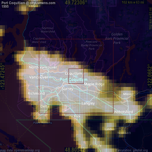
» NASA, Earths city lights 1995
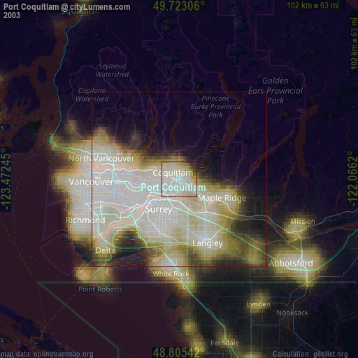
» NASA city lights 2003
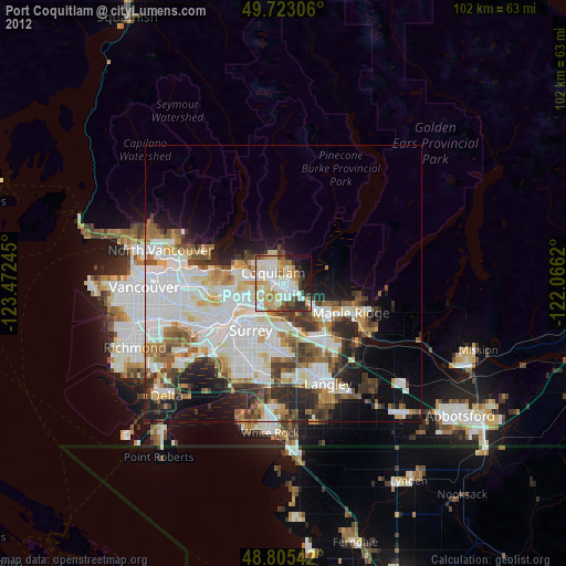
» Earth at Night: Flat Maps 2012, 2016