Richmond night lights from space
Night Light of Richmond (British Columbia) from space (Canada) Src. Average luminocity for 10x10km area is 82.5868% and for 50x50km: 30.1971%.
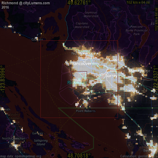
Analysis of Richmond night lights 2016
Square area 10x10 km:
 39.36%
90-99
23.81%80-89
7%70-79
6.44%60-69
2.94%50-59
3.36%40-49
4.34%30-39
5.88%20-29
6.02%10-19
0.84%0-9
0%Square area 50x50 km:
11.11%90-99
7.88%80-89
2.58%70-79
2.33%60-69
2.07%50-59
2.43%40-49
2.18%30-39
2.83%20-29
5.14%10-19
7.74%0-9
53.72%Clear (daylight) street map image can be seen on geolist.org.
Map coordinates:
49° 37' 39.4" North, 123° 50' 23.9" West
49° 10' 12.1" North, 123° 8' 12.6" West
48° 42' 29.4" North, 122° 26' 1.4" West
Some cities around Richmond sort by population:
• Vancouver
8.9 km =5.5 mi,  8°
8°
• Burnaby
17.1 km =10.6 mi,  51°
51°
• Ladner
9.8 km =6.1 mi,  156°
156°
• Delta
17 km =10.6 mi,  99°
99°
• New Westminster
16.9 km =10.5 mi,  76°
76°
• North Vancouver
17 km =10.6 mi,  16°
16°
• West End
12.6 km =7.8 mi,  1°
1°
• Tsawwassen
17.5 km =10.9 mi,  167°
167°
6122085 (p: 182,000)
Sources (retrieved 2019-11-25):
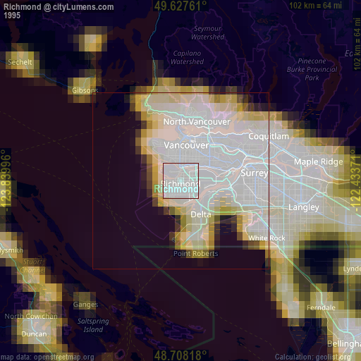
» NASA, Earths city lights 1995
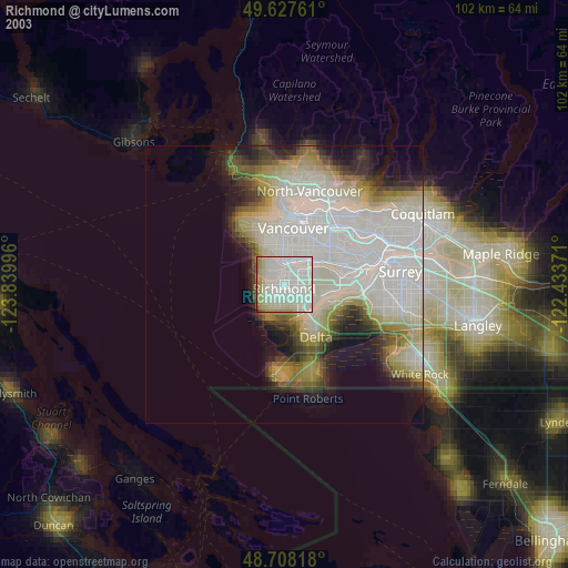
» NASA city lights 2003
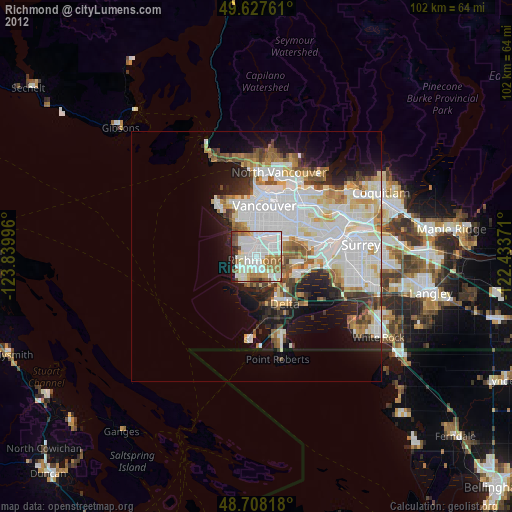
» Earth at Night: Flat Maps 2012, 2016