Port Moody night lights from space
Night Light of Port Moody (British Columbia) from space (Canada) Src. Average luminocity for 10x10km area is 76.1765% and for 50x50km: 36.3145%.
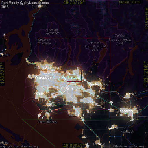
Analysis of Port Moody night lights 2016
Square area 10x10 km:
 21.39%
90-99
28.34%80-89
8.96%70-79
9.89%60-69
6.82%50-59
5.61%40-49
2.01%30-39
2.67%20-29
12.3%10-19
2.01%0-9
0%Square area 50x50 km:
12.91%90-99
9.55%80-89
3.09%70-79
2.89%60-69
2.43%50-59
3.1%40-49
3.36%30-39
4.6%20-29
6.25%10-19
7.35%0-9
44.46%Clear (daylight) street map image can be seen on geolist.org.
Map coordinates:
49° 44' 16" North, 123° 31' 39.7" West
49° 16' 52.5" North, 122° 49' 28.5" West
48° 49' 13.5" North, 122° 7' 17.2" West
Some cities around Port Moody sort by population:
• Burnaby
9.4 km =5.8 mi,  259°
259°
• Coquitlam
3.1 km =1.9 mi,  83°
83°
• Delta
16.4 km =10.2 mi,  201°
201°
• Maple Ridge
17.6 km =10.9 mi,  113°
113°
• New Westminster
10.4 km =6.5 mi,  217°
217°
• North Vancouver
18.2 km =11.3 mi,  282°
282°
• Walnut Grove
18.6 km =11.6 mi,  134°
134°
• Pitt Meadows
11.9 km =7.4 mi,  124°
124°
6111962 (p: 27,512)
Sources (retrieved 2019-11-25):
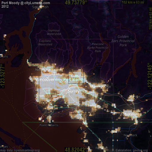
» Earth at Night: Flat Maps 2012, 2016