Surrey night lights from space
Night Light of Surrey (British Columbia) from space (Canada) Src. Average luminocity for 10x10km area is 63.521% and for 50x50km: 38.6366%.
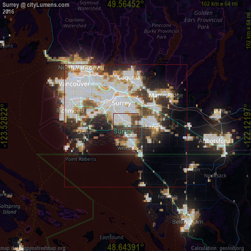
Analysis of Surrey night lights 2016
Square area 10x10 km:
 20.17%
90-99
18.35%80-89
4.2%70-79
2.94%60-69
3.5%50-59
2.8%40-49
10.64%30-39
25.07%20-29
8.4%10-19
3.78%0-9
0.14%Square area 50x50 km:
13.56%90-99
9.99%80-89
3.24%70-79
3.05%60-69
2.54%50-59
3.42%40-49
3.62%30-39
4.99%20-29
6.51%10-19
8.21%0-9
40.87%Clear (daylight) street map image can be seen on geolist.org.
Map coordinates:
49° 33' 52.3" North, 123° 31' 41.6" West
49° 6' 22.9" North, 122° 49' 30.3" West
48° 38' 38.1" North, 122° 7' 19.1" West
Some cities around Surrey sort by population:
• Delta
7.3 km =4.5 mi,  305°
305°
• White Rock
10.1 km =6.3 mi,  170°
170°
• New Westminster
12.8 km =8 mi,  330°
330°
• Port Coquitlam
18.2 km =11.3 mi,  12°
12°
• Walnut Grove
14.9 km =9.3 mi,  64°
64°
• Langley
12.1 km =7.5 mi,  92°
92°
• Pitt Meadows
16.1 km =10 mi,  37°
37°
• Blaine, US
13.8 km =8.6 mi,  155°
155°
6159905 (p: 394,976)
Sources (retrieved 2019-11-25):
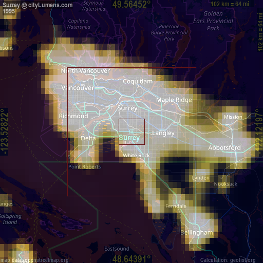
» NASA, Earths city lights 1995
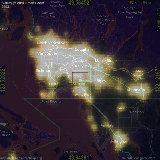
» NASA city lights 2003
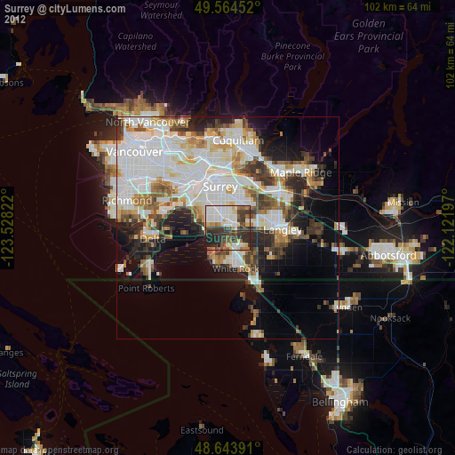
» Earth at Night: Flat Maps 2012, 2016