Valente night lights from space
Night Light of Valente (Bahia) from space (Brazil) Src. Average luminocity for 10x10km area is 16.0455% and for 50x50km: 5.6169%.
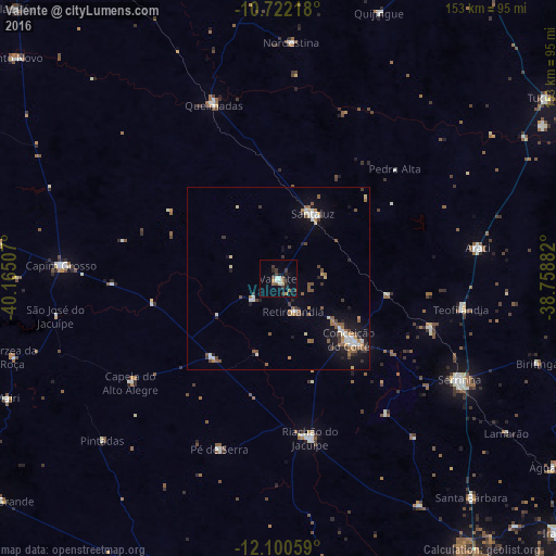
Analysis of Valente night lights 2016
Square area 10x10 km:
 2.38%
2.38%90-99
1.95%80-89
0.87%70-79
0.22%60-69
2.38%50-59
2.38%40-49
1.95%30-39
5.84%20-29
3.25%10-19
4.98%0-9
73.81%Square area 50x50 km:
0.62%90-99
0.81%80-89
0.41%70-79
0.55%60-69
0.73%50-59
1.19%40-49
0.71%30-39
0.94%20-29
0.79%10-19
3.37%0-9
89.88%Clear (daylight) street map image can be seen on geolist.org.
Map coordinates:
10° 43' 19.8" South, 40° 9' 54.3" West
11° 24' 44" South, 39° 27' 43" West
12° 6' 2.1" South, 38° 45' 31.8" West
Some cities around Valente sort by population:
• Serrinha
56.9 km =35.4 mi,  119°
119°
• Conceição do Coité
25.8 km =16 mi,  130°
130°
• Santaluz
19.8 km =12.3 mi,  28°
28°
• Capim Grosso
60.1 km =37.3 mi,  273°
273°
• Riachão do Jacuípe
44.7 km =27.8 mi,  169°
169°
• Araci
54.7 km =34 mi,  80°
80°
• Mairi
81.9 km =50.9 mi,  246°
246°
• Queimadas
51.5 km =32 mi,  339°
339°
3445594 (p: 12,588)
Sources (retrieved 2019-11-25):
» Earth at Night: Flat Maps 2012, 2016