Serrinha night lights from space
Night Light of Serrinha (Bahia) from space (Brazil) Src. Average luminocity for 10x10km area is 33.3398% and for 50x50km: 4.217%.
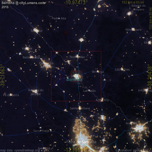
Analysis of Serrinha night lights 2016
Square area 10x10 km:
 4.98%
4.98%90-99
9.74%80-89
3.68%70-79
0.65%60-69
1.95%50-59
5.19%40-49
3.46%30-39
5.84%20-29
7.36%10-19
34.63%0-9
22.51%Square area 50x50 km:
0.3%90-99
0.73%80-89
0.33%70-79
0.13%60-69
0.38%50-59
0.94%40-49
0.75%30-39
0.85%20-29
1.07%10-19
2.34%0-9
92.16%Clear (daylight) street map image can be seen on geolist.org.
Map coordinates:
10° 58' 29" South, 39° 42' 38.3" West
11° 39' 51" South, 39° 0' 27" West
12° 21' 6.9" South, 38° 18' 15.8" West
Some cities around Serrinha sort by population:
• Feira de Santana
67.1 km =41.7 mi,  176°
176°
• Conceição do Coité
32 km =19.9 mi,  290°
290°
• Santaluz
60.5 km =37.6 mi,  318°
318°
• Riachão do Jacuípe
44.1 km =27.4 mi,  248°
248°
• Araci
37.1 km =23.1 mi,  6°
6°
• Valente
56.9 km =35.4 mi,  299°
299°
• Anguera
60.1 km =37.3 mi,  205°
205°
• Irará
50.3 km =31.3 mi,  148°
148°
3447690 (p: 49,078)
Sources (retrieved 2019-11-25):
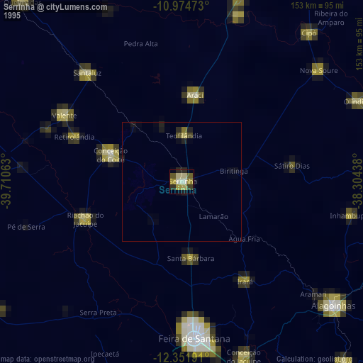
» NASA, Earths city lights 1995
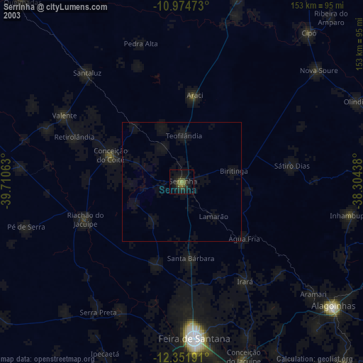
» NASA city lights 2003
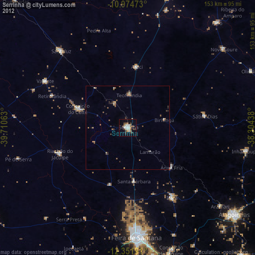
» Earth at Night: Flat Maps 2012, 2016