São Sebastião night lights from space
Night Light of São Sebastião (São Paulo) from space (Brazil) Src. Average luminocity for 10x10km area is 26.2024% and for 50x50km: 7.2702%.
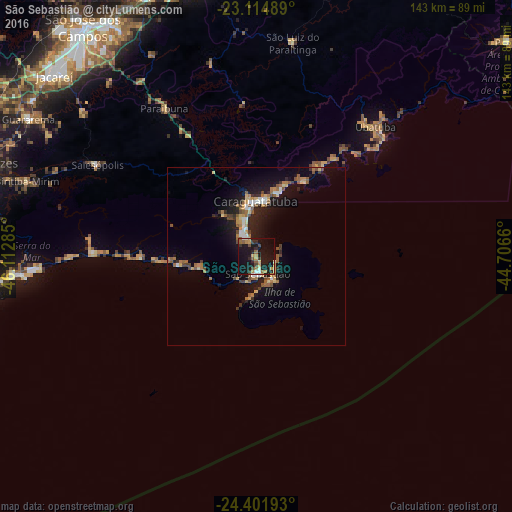

Analysis of São Sebastião night lights 2016
Square area 10x10 km:
 1.39%
1.39%90-99
2.18%80-89
2.18%70-79
6.15%60-69
3.57%50-59
3.97%40-49
3.37%30-39
3.37%20-29
5.36%10-19
49.8%0-9
18.65%Square area 50x50 km:
0.58%90-99
0.69%80-89
0.79%70-79
0.95%60-69
1.41%50-59
1.38%40-49
0.92%30-39
0.74%20-29
1.5%10-19
7.69%0-9
83.36%Clear (daylight) street map image can be seen on geolist.org.
Map coordinates:
23° 6' 53.6" South, 46° 6' 46.3" West
23° 45' 36" South, 45° 24' 35" West
24° 24' 6.9" South, 44° 42' 23.8" West
Some cities around São Sebastião sort by population:
• Jacareí
76 km =47.2 mi,  311°
311°
• Caraguatatuba
15.5 km =9.6 mi,  358°
358°
• Ubatuba
50.1 km =31.1 mi,  43°
43°
• Bertioga
74.9 km =46.5 mi,  261°
261°
• Ilhabela
5.6 km =3.5 mi,  110°
110°
• Biritiba Mirim
67.4 km =41.9 mi,  288°
288°
• Guararema
74.4 km =46.2 mi,  301°
301°
• Santa Branca
63 km =39.1 mi, 309°
3448257 (p: 76,367)
Sources (retrieved 2019-11-25):
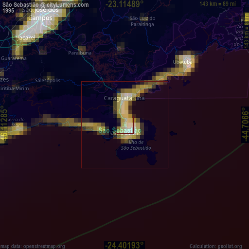
» NASA, Earths city lights 1995
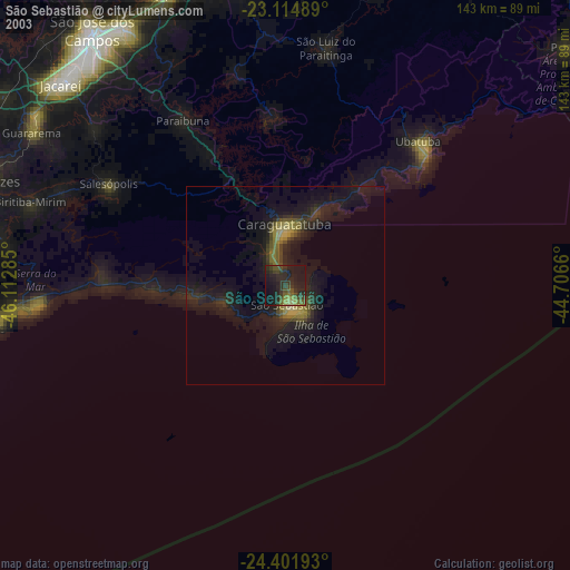
» NASA city lights 2003
» Earth at Night: Flat Maps 2012, 2016