Bertioga night lights from space
Night Light of Bertioga (São Paulo) from space (Brazil) Src. Average luminocity for 10x10km area is 31.5556% and for 50x50km: 17.9539%.
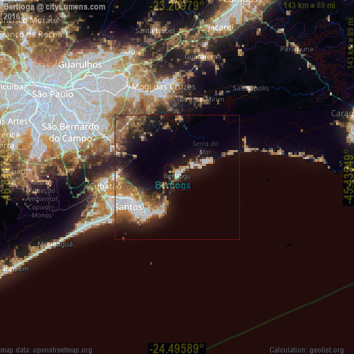
Analysis of Bertioga night lights 2016
Square area 10x10 km:
 4.37%
4.37%90-99
4.37%80-89
3.77%70-79
3.37%60-69
3.57%50-59
3.37%40-49
4.76%30-39
8.33%20-29
8.93%10-19
35.52%0-9
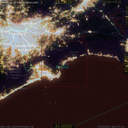
19.64%Square area 50x50 km:
2.77%90-99
2.4%80-89
1.39%70-79
1.9%60-69
3.39%50-59
3.77%40-49
3.27%30-39
2.98%20-29
4.11%10-19
11.49%0-9
62.52%Clear (daylight) street map image can be seen on geolist.org.
Map coordinates:
23° 12' 35.2" South, 46° 50' 30.3" West
23° 51' 16" South, 46° 8' 19" West
24° 29' 45.2" South, 45° 26' 7.8" West
Some cities around Bertioga sort by population:
• Santos
23.1 km =14.4 mi,  239°
239°
• São Vicente
28.4 km =17.6 mi, 244°
• Guarujá
19.5 km =12.1 mi,  217°
217°
• Praia Grande
31.7 km =19.7 mi, 237°
• Cubatão
29.5 km =18.3 mi,  261°
261°
• Ribeirão Pires
32.2 km =20 mi,  299°
299°
• Rio Grande da Serra
29.1 km =18.1 mi,  294°
294°
• Biritiba Mirim
33 km =20.5 mi,  17°
17°
3470052 (p: 35,759)
Sources (retrieved 2019-11-25):
» Earth at Night: Flat Maps 2012, 2016