Biritiba Mirim night lights from space
Night Light of Biritiba Mirim (São Paulo) from space (Brazil) Src. Average luminocity for 10x10km area is 16.1944% and for 50x50km: 19.2456%.
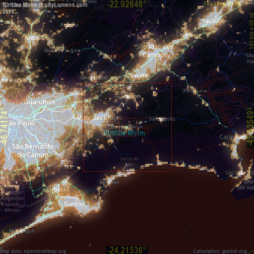
Analysis of Biritiba Mirim night lights 2016
Square area 10x10 km:
 0%
0%90-99
0%80-89
1.59%70-79
0%60-69
0.99%50-59
5.95%40-49
3.97%30-39
9.92%20-29
4.76%10-19
11.31%0-9
61.51%Square area 50x50 km:
1.31%90-99
1.62%80-89
1.74%70-79
2.54%60-69
4%50-59
4.81%40-49
4.3%30-39
4.75%20-29
6.61%10-19
11.06%0-9
57.25%Clear (daylight) street map image can be seen on geolist.org.
Map coordinates:
22° 55' 35.3" South, 46° 44' 30.3" West
23° 34' 21" South, 46° 2' 19" West
24° 12' 55.3" South, 45° 20' 7.8" West
Some cities around Biritiba Mirim sort by population:
• Itaquaquecetuba
33 km =20.5 mi,  286°
286°
• Mogi das Cruzes
16.2 km =10.1 mi, 289°
• Suzano
27.9 km =17.3 mi,  276°
276°
• Jacareí
30.6 km =19 mi,  14°
14°
• Poá
31.6 km =19.6 mi, 278°
• Bertioga
33 km =20.5 mi,  197°
197°
• Guararema
17.5 km =10.9 mi,  1°
1°
• Santa Branca
25.1 km =15.6 mi,  38°
38°
3469984 (p: 26,459)
Sources (retrieved 2019-11-25):
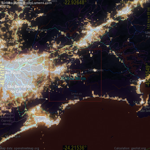
» Earth at Night: Flat Maps 2012, 2016