Santa Branca night lights from space
Night Light of Santa Branca (São Paulo) from space (Brazil) Src. Average luminocity for 10x10km area is 8.6932% and for 50x50km: 20.7502%.
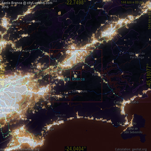
Analysis of Santa Branca night lights 2016
Square area 10x10 km:
 0%
0%90-99
0%80-89
2.46%70-79
1.33%60-69
1.33%50-59
0.95%40-49
1.52%30-39
0.76%20-29
0.76%10-19
6.82%0-9
84.09%Square area 50x50 km:
2.72%90-99
2.97%80-89
1.94%70-79
2.89%60-69
3.84%50-59
4.32%40-49
3.47%30-39
4.04%20-29
5.27%10-19
9.83%0-9
58.71%Clear (daylight) street map image can be seen on geolist.org.
Map coordinates:
22° 44' 59.3" South, 46° 35' 13.3" West
23° 23' 48" South, 45° 53' 2" West
24° 2' 25.4" South, 45° 10' 50.8" West
Some cities around Santa Branca sort by population:
• São José dos Campos
24.2 km =15 mi,  359°
359°
• Mogi das Cruzes
34.1 km =21.2 mi,  245°
245°
• Suzano
46.5 km =28.9 mi, 249°
• Jacareí
13.2 km =8.2 mi,  320°
320°
• Caçapava
37.5 km =23.3 mi,  28°
28°
• Arujá
44.6 km =27.7 mi,  270°
270°
• Biritiba Mirim
25.1 km =15.6 mi,  218°
218°
• Guararema
15.6 km =9.7 mi,  262°
262°
3450400 (p: 8,659)
Sources (retrieved 2019-11-25):
» Earth at Night: Flat Maps 2012, 2016