Ubatuba night lights from space
Night Light of Ubatuba (São Paulo) from space (Brazil) Src. Average luminocity for 10x10km area is 26.3826% and for 50x50km: 3.0443%.
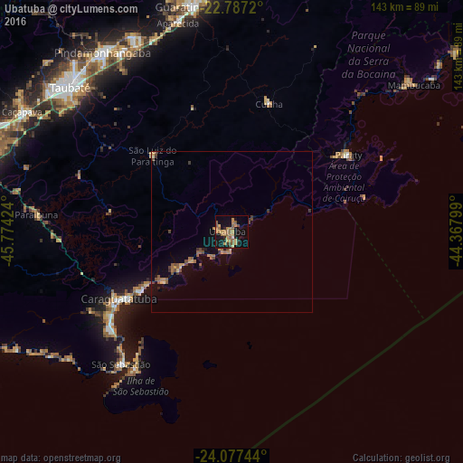
Analysis of Ubatuba night lights 2016
Square area 10x10 km:
 0.38%
0.38%90-99
0.38%80-89
3.22%70-79
7.39%60-69
7.39%50-59
8.52%40-49
1.52%30-39
1.89%20-29
4.17%10-19
28.41%0-9
36.74%Square area 50x50 km:
0.02%90-99
0.05%80-89
0.37%70-79
0.61%60-69
0.67%50-59
0.82%40-49
0.55%30-39
0.41%20-29
0.31%10-19
1.9%0-9
94.3%Clear (daylight) street map image can be seen on geolist.org.
Map coordinates:
22° 47' 13.9" South, 45° 46' 27.3" West
23° 26' 2" South, 45° 4' 16" West
24° 4' 38.8" South, 44° 22' 4.8" West
Some cities around Ubatuba sort by population:
• Taubaté
67.1 km =41.7 mi,  312°
312°
• Pindamonhangaba
69.3 km =43.1 mi,  324°
324°
• Caraguatatuba
40.6 km =25.2 mi,  239°
239°
• São Sebastião
50.1 km =31.1 mi,  223°
223°
• Aparecida
67.2 km =41.8 mi,  346°
346°
• Ilhabela
48.2 km =30 mi, 217°
• Paraty
43.7 km =27.2 mi,  56°
56°
• Cunha
41.6 km =25.8 mi,  15°
15°
3445847 (p: 79,007)
Sources (retrieved 2019-11-25):
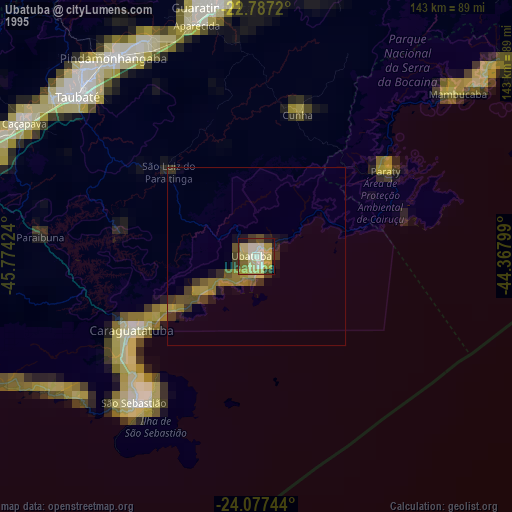
» NASA, Earths city lights 1995
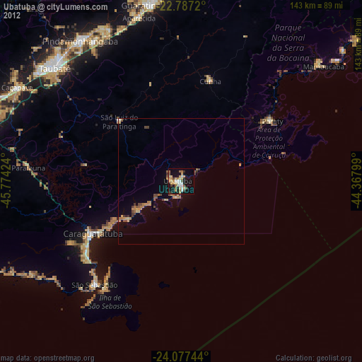
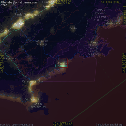
» NASA city lights 2003
» Earth at Night: Flat Maps 2012, 2016