São Felipe night lights from space
Night Light of São Felipe (Bahia) from space (Brazil) Src. Average luminocity for 10x10km area is 0% and for 50x50km: 0.6156%.
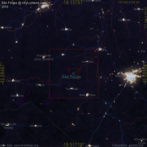
Analysis of São Felipe night lights 2016
Square area 10x10 km:
 0%
0%90-99
0%80-89
0%70-79
0%60-69
0%50-59
0%40-49
0%30-39
0%20-29
0%10-19
0%0-9
100%Square area 50x50 km:
0.01%90-99
0.29%80-89
0.07%70-79
0.07%60-69
0.02%50-59
0.07%40-49
0.03%30-39
0.1%20-29
0.07%10-19
0.1%0-9
99.17%Clear (daylight) street map image can be seen on geolist.org.
Map coordinates:
14° 9' 28.3" South, 42° 5' 41.5" West
14° 50' 19" South, 41° 23' 30.3" West
15° 31' 1.9" South, 40° 41' 19" West
Some cities around São Felipe sort by population:
• Vitória da Conquista
59.4 km =36.9 mi,  92°
92°
• Brumado
76.5 km =47.5 mi,  337°
337°
• Itambé
94 km =58.4 mi,  118°
118°
• Águas Vermelhas
101.3 km =62.9 mi,  184°
184°
• Santana
60.3 km =37.5 mi,  313°
313°
• Caculé
96.8 km =60.1 mi,  292°
292°
• São João do Paraíso
85.2 km =52.9 mi,  231°
231°
• Tanhaçu
92.2 km =57.3 mi,  9°
9°
3449216 (p: 9,574)
Sources (retrieved 2019-11-25):
» Earth at Night: Flat Maps 2012, 2016