Santana night lights from space
Night Light of Santana (Bahia) from space (Brazil) Src. Average luminocity for 10x10km area is 0% and for 50x50km: 0.7152%.
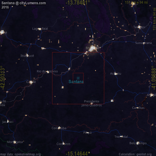
Analysis of Santana night lights 2016
Square area 10x10 km:
 0%
0%90-99
0%80-89
0%70-79
0%60-69
0%50-59
0%40-49
0%30-39
0%20-29
0%10-19
0%0-9
100%Square area 50x50 km:
0.06%90-99
0.09%80-89
0.07%70-79
0.03%60-69
0.07%50-59
0.21%40-49
0.1%30-39
0.2%20-29
0.05%10-19
0.59%0-9
98.53%Clear (daylight) street map image can be seen on geolist.org.
Map coordinates:
13° 47' 5.3" South, 42° 30' 11.3" West
14° 28' 0" South, 41° 48' 0" West
15° 8' 47.2" South, 41° 5' 48.8" West
Some cities around Santana sort by population:
• Brumado
32.7 km =20.3 mi,  26°
26°
• Caetité
85.1 km =52.9 mi,  301°
301°
• Livramento do Brumado
90.8 km =56.4 mi,  356°
356°
• Barra da Estiva
106.5 km =66.2 mi, 28°
• Caculé
45.6 km =28.3 mi,  264°
264°
• São Felipe
60.3 km =37.5 mi,  133°
133°
• São João do Paraíso
96.9 km =60.2 mi,  193°
193°
• Tanhaçu
77.4 km =48.1 mi,  50°
50°
3450031 (p: 12,628)
Sources (retrieved 2019-11-25):
» Earth at Night: Flat Maps 2012, 2016