Santana do Acaraú night lights from space
Night Light of Santana do Acaraú (Ceará) from space (Brazil) Src. Average luminocity for 10x10km area is 7.1602% and for 50x50km: 3.454%.
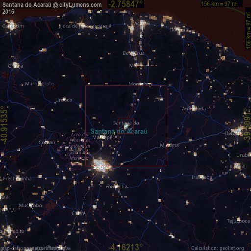
Analysis of Santana do Acaraú night lights 2016
Square area 10x10 km:
 1.08%
1.08%90-99
1.52%80-89
0.87%70-79
0%60-69
0.87%50-59
0.87%40-49
0.87%30-39
3.25%20-29
0.22%10-19
0%0-9
90.48%Square area 50x50 km:
0.35%90-99
0.67%80-89
0.22%70-79
0.06%60-69
0.41%50-59
0.74%40-49
0.58%30-39
0.68%20-29
0.93%10-19
2.17%0-9
93.19%Clear (daylight) street map image can be seen on geolist.org.
Map coordinates:
2° 45' 30.5" South, 40° 54' 55.3" West
3° 27' 38" South, 40° 12' 44" West
4° 9' 43.7" South, 39° 30' 32.8" West
Some cities around Santana do Acaraú sort by population:
• Sobral
29.4 km =18.3 mi,  211°
211°
• Marco
38.1 km =23.7 mi,  10°
10°
• Amontada
43.6 km =27.1 mi,  75°
75°
• Forquilha
37.9 km =23.5 mi,  188°
188°
• Irauçuba
57.2 km =35.5 mi,  123°
123°
• Bela Cruz
45.9 km =28.5 mi, 6°
• Coreaú
50 km =31.1 mi,  260°
260°
• Cruz
60.1 km =37.3 mi,  3°
3°
3389387 (p: 14,707)
Sources (retrieved 2019-11-25):
» Earth at Night: Flat Maps 2012, 2016