Marco night lights from space
Night Light of Marco (Ceará) from space (Brazil) Src. Average luminocity for 10x10km area is 12.1883% and for 50x50km: 4.0556%.
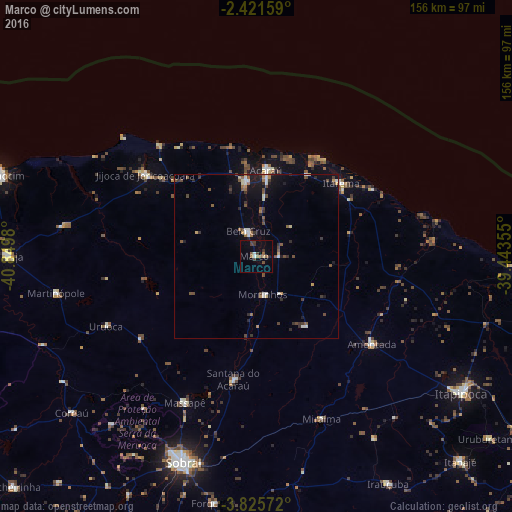
Analysis of Marco night lights 2016
Square area 10x10 km:
 0.87%
0.87%90-99
0.87%80-89
0.87%70-79
0%60-69
3.25%50-59
2.16%40-49
1.52%30-39
5.19%20-29
0.87%10-19
0.87%0-9
83.55%Square area 50x50 km:
0.22%90-99
0.64%80-89
0.26%70-79
0.31%60-69
0.53%50-59
0.8%40-49
0.8%30-39
0.85%20-29
0.81%10-19
1.9%0-9
92.88%Clear (daylight) street map image can be seen on geolist.org.
Map coordinates:
2° 25' 17.7" South, 40° 50' 59.3" West
3° 7' 26" South, 40° 8' 48" West
3° 49' 32.6" South, 39° 26' 36.8" West
Some cities around Marco sort by population:
• Sobral
66.5 km =41.3 mi,  199°
199°
• Itapipoca
75.3 km =46.8 mi,  123°
123°
• Acaraú
26.7 km =16.6 mi,  6°
6°
• Santana do Acaraú
38.1 km =23.7 mi,  190°
190°
• Amontada
43.8 km =27.2 mi,  127°
127°
• Bela Cruz
8.5 km =5.3 mi,  343°
343°
• Coreaú
72.6 km =45.1 mi,  231°
231°
• Cruz
22.8 km =14.2 mi,  351°
351°
3395404 (p: 14,501)
Sources (retrieved 2019-11-25):
» Earth at Night: Flat Maps 2012, 2016