Amontada night lights from space
Night Light of Amontada (Ceará) from space (Brazil) Src. Average luminocity for 10x10km area is 11.3831% and for 50x50km: 2.3615%.
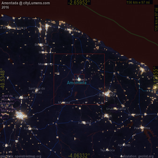
Analysis of Amontada night lights 2016
Square area 10x10 km:
 1.3%
1.3%90-99
2.16%80-89
0.87%70-79
0.87%60-69
1.95%50-59
1.3%40-49
1.73%30-39
1.52%20-29
3.46%10-19
1.73%0-9
83.12%Square area 50x50 km:
0.06%90-99
0.25%80-89
0.14%70-79
0.19%60-69
0.23%50-59
0.59%40-49
0.65%30-39
0.69%20-29
0.86%10-19
1%0-9
95.34%Clear (daylight) street map image can be seen on geolist.org.
Map coordinates:
2° 39' 34.3" South, 40° 32' 5.3" West
3° 21' 42" South, 39° 49' 54" West
4° 3' 48" South, 39° 7' 42.8" West
Some cities around Amontada sort by population:
• Itapipoca
31.7 km =19.7 mi,  117°
117°
• Itapagé
45.3 km =28.1 mi,  142°
142°
• Acaraú
61.9 km =38.5 mi,  328°
328°
• Santana do Acaraú
43.6 km =27.1 mi,  255°
255°
• Marco
43.8 km =27.2 mi,  307°
307°
• Irauçuba
43.1 km =26.8 mi,  172°
172°
• Bela Cruz
50.9 km =31.6 mi, 312°
• Uruburetama
46.3 km =28.8 mi,  129°
129°
3407703 (p: 13,520)
Sources (retrieved 2019-11-25):
» Earth at Night: Flat Maps 2012, 2016