Bela Cruz night lights from space
Night Light of Bela Cruz (Ceará) from space (Brazil) Src. Average luminocity for 10x10km area is 14.4459% and for 50x50km: 5.5058%.
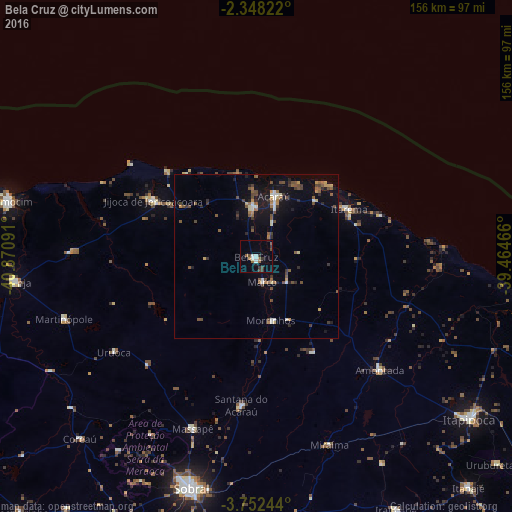
Analysis of Bela Cruz night lights 2016
Square area 10x10 km:
 2.16%
2.16%90-99
2.16%80-89
0%70-79
0.87%60-69
2.38%50-59
1.95%40-49
2.6%30-39
3.9%20-29
1.73%10-19
3.25%0-9
79%Square area 50x50 km:
0.27%90-99
0.72%80-89
0.39%70-79
0.54%60-69
0.68%50-59
1.22%40-49
1.24%30-39
0.91%20-29
0.88%10-19
3.39%0-9
89.76%Clear (daylight) street map image can be seen on geolist.org.
Map coordinates:
2° 20' 53.6" South, 40° 52' 15.3" West
3° 3' 2" South, 40° 10' 4" West
3° 45' 8.8" South, 39° 27' 52.8" West
Some cities around Bela Cruz sort by population:
• Sobral
73.5 km =45.7 mi,  195°
195°
• Acaraú
19.1 km =11.9 mi,  16°
16°
• Granja
73.5 km =45.7 mi,  263°
263°
• Santana do Acaraú
45.9 km =28.5 mi,  186°
186°
• Marco
8.5 km =5.3 mi,  163°
163°
• Amontada
50.9 km =31.6 mi,  132°
132°
• Coreaú
76.3 km =47.4 mi,  225°
225°
• Cruz
14.4 km =8.9 mi,  356°
356°
3405908 (p: 12,715)
Sources (retrieved 2019-11-25):
» Earth at Night: Flat Maps 2012, 2016