Cruz night lights from space
Night Light of Cruz (Ceará) from space (Brazil) Src. Average luminocity for 10x10km area is 22.0065% and for 50x50km: 5.3158%.
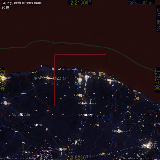
Analysis of Cruz night lights 2016
Square area 10x10 km:
 1.08%
1.08%90-99
3.25%80-89
1.73%70-79
1.52%60-69
2.81%50-59
3.9%40-49
4.55%30-39
2.6%20-29
3.9%10-19
38.74%0-9
35.93%Square area 50x50 km:
0.26%90-99
0.61%80-89
0.42%70-79
0.51%60-69
0.66%50-59
1.3%40-49
1.24%30-39
0.85%20-29
0.9%10-19
3.34%0-9
89.92%Clear (daylight) street map image can be seen on geolist.org.
Map coordinates:
2° 13' 7.3" South, 40° 52' 44.5" West
2° 55' 16" South, 40° 10' 33.2" West
3° 37' 23.1" South, 39° 28' 22" West
Some cities around Cruz sort by population:
• Camocim
73.9 km =45.9 mi,  271°
271°
• Acaraú
7.4 km =4.6 mi,  57°
57°
• Granja
75.5 km =46.9 mi,  252°
252°
• Santana do Acaraú
60.1 km =37.3 mi,  183°
183°
• Marco
22.8 km =14.2 mi,  171°
171°
• Amontada
62.1 km =38.6 mi,  142°
142°
• Bela Cruz
14.4 km =8.9 mi, 176°
• Coreaú
86.5 km =53.7 mi,  218°
218°
3401487 (p: 8,723)
Sources (retrieved 2019-11-25):
» Earth at Night: Flat Maps 2012, 2016