Riachão das Neves night lights from space
Night Light of Riachão das Neves (Bahia) from space (Brazil) Src. Average luminocity for 10x10km area is 5.2025% and for 50x50km: 0.3354%.
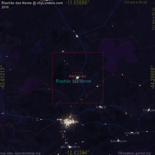
Analysis of Riachão das Neves night lights 2016
Square area 10x10 km:
 0.62%
0.62%90-99
1.03%80-89
0.83%70-79
0.21%60-69
1.24%50-59
1.03%40-49
0.83%30-39
0.83%20-29
0%10-19
0.62%0-9
92.77%Square area 50x50 km:
0.03%90-99
0.04%80-89
0.07%70-79
0.01%60-69
0.05%50-59
0.04%40-49
0.17%30-39
0.07%20-29
0.03%10-19
0.03%0-9
99.47%Clear (daylight) street map image can be seen on geolist.org.
Map coordinates:
11° 3' 24.7" South, 45° 36' 47.3" West
11° 44' 46" South, 44° 54' 36" West
12° 26' 1.1" South, 44° 12' 24.8" West
Some cities around Riachão das Neves sort by population:
• Barreiras
46 km =28.6 mi,  190°
190°
• Santa Maria da Vitória
198.2 km =123.2 mi,  157°
157°
• Barra
206.1 km =128.1 mi,  69°
69°
• Ibotirama
190.1 km =118.1 mi,  104°
104°
• Formosa do Rio Preto
83.5 km =51.9 mi,  338°
338°
• Taguatinga
181.3 km =112.7 mi,  246°
246°
• Correntina
180.1 km =111.9 mi,  170°
170°
• São Desidério
69 km =42.9 mi, 185°
3451478 (p: 11,236)
Sources (retrieved 2019-11-25):
» Earth at Night: Flat Maps 2012, 2016