Formosa do Rio Preto night lights from space
Night Light of Formosa do Rio Preto (Bahia) from space (Brazil) Src. Average luminocity for 10x10km area is 11.0909% and for 50x50km: 0.4704%.
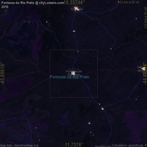
Analysis of Formosa do Rio Preto night lights 2016
Square area 10x10 km:
 0.43%
0.43%90-99
3.68%80-89
1.08%70-79
0%60-69
1.73%50-59
3.25%40-49
1.95%30-39
0.87%20-29
0%10-19
0%0-9
87.01%Square area 50x50 km:
0.02%90-99
0.14%80-89
0.04%70-79
0%60-69
0.07%50-59
0.16%40-49
0.08%30-39
0.03%20-29
0%10-19
0%0-9
99.46%Clear (daylight) street map image can be seen on geolist.org.
Map coordinates:
10° 21' 26.8" South, 45° 53' 46.3" West
11° 2' 54" South, 45° 11' 35" West
11° 44' 15.4" South, 44° 29' 23.8" West
Some cities around Formosa do Rio Preto sort by population:
• Barreiras
124.8 km =77.5 mi,  169°
169°
• Barra
223.9 km =139.1 mi,  91°
91°
• Ibotirama
249.3 km =154.9 mi,  120°
120°
• Taguatinga
202.6 km =125.9 mi,  221°
221°
• Correntina
262.2 km =162.9 mi, 166°
• Bom Jesus
237.7 km =147.7 mi,  22°
22°
• Riachão das Neves
83.5 km =51.9 mi,  158°
158°
• São Desidério
148.2 km =92.1 mi, 170°
3463124 (p: 14,354)
Sources (retrieved 2019-11-25):
» Earth at Night: Flat Maps 2012, 2016