Taguatinga night lights from space
Night Light of Taguatinga (Tocantins) from space (Brazil) Src. Average luminocity for 10x10km area is 6.1715% and for 50x50km: 0.2769%.
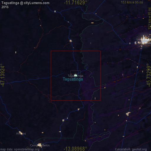
Analysis of Taguatinga night lights 2016
Square area 10x10 km:
 0.41%
0.41%90-99
1.03%80-89
2.69%70-79
0.83%60-69
0%50-59
0%40-49
1.65%30-39
0%20-29
0%10-19
0.83%0-9
92.56%Square area 50x50 km:
0.02%90-99
0.04%80-89
0.11%70-79
0.03%60-69
0%50-59
0%40-49
0.07%30-39
0.05%20-29
0.02%10-19
0.03%0-9
99.63%Clear (daylight) street map image can be seen on geolist.org.
Map coordinates:
11° 42' 58.6" South, 47° 8' 21.3" West
12° 24' 14" South, 46° 26' 10" West
13° 5' 22.8" South, 45° 43' 58.8" West
Some cities around Taguatinga sort by population:
• Barreiras
159.6 km =99.2 mi,  79°
79°
• Posse
188 km =116.8 mi,  177°
177°
• Campos Belos
79.2 km =49.2 mi,  207°
207°
• Formosa do Rio Preto
202.6 km =125.9 mi,  41°
41°
• Riachão das Neves
181.3 km =112.7 mi,  66°
66°
• Arraias
80.1 km =49.8 mi,  222°
222°
• Iaciara
189.3 km =117.6 mi,  186°
186°
• São Desidério
158.9 km =98.7 mi,  88°
88°
3447075 (p: 13,711)
Sources (retrieved 2019-11-25):
» Earth at Night: Flat Maps 2012, 2016