Pindobaçu night lights from space
Night Light of Pindobaçu (Bahia) from space (Brazil) Src. Average luminocity for 10x10km area is 3.5702% and for 50x50km: 1.332%.
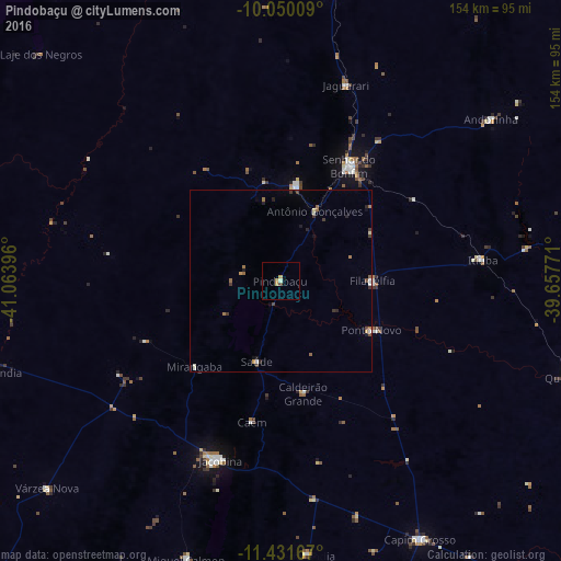
Analysis of Pindobaçu night lights 2016
Square area 10x10 km:
 0%
0%90-99
0.83%80-89
0.83%70-79
1.65%60-69
0%50-59
0%40-49
0.83%30-39
0%20-29
0%10-19
0%0-9
95.87%Square area 50x50 km:
0.07%90-99
0.24%80-89
0.12%70-79
0.16%60-69
0.25%50-59
0.19%40-49
0.26%30-39
0.25%20-29
0.27%10-19
0.22%0-9
97.97%Clear (daylight) street map image can be seen on geolist.org.
Map coordinates:
10° 3' 0.3" South, 41° 3' 50.3" West
10° 44' 30" South, 40° 21' 39" West
11° 25' 54" South, 39° 39' 27.8" West
Some cities around Pindobaçu sort by population:
• Senhor do Bonfim
36.4 km =22.6 mi,  31°
31°
• Jacobina
51.7 km =32.1 mi,  198°
198°
• Campo Formoso
26.4 km =16.4 mi,  9°
9°
• Jaguarari
56.1 km =34.9 mi,  18°
18°
• Capim Grosso
80.6 km =50.1 mi,  151°
151°
• Miguel Calmon
80.6 km =50.1 mi, 198°
• Queimadas
84.4 km =52.4 mi,  108°
108°
• Ponto Novo
28.2 km =17.5 mi,  118°
118°
3453827 (p: 17,229)
Sources (retrieved 2019-11-25):
» Earth at Night: Flat Maps 2012, 2016