Paraty night lights from space
Night Light of Paraty (Rio de Janeiro) from space (Brazil) Src. Average luminocity for 10x10km area is 13.0095% and for 50x50km: 1.5319%.
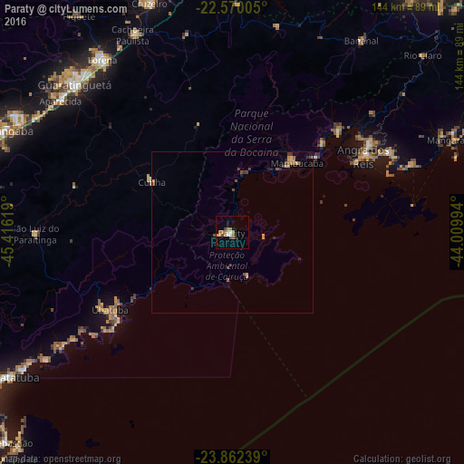
Analysis of Paraty night lights 2016
Square area 10x10 km:
 1.33%
1.33%90-99
1.14%80-89
1.33%70-79
1.52%60-69
3.98%50-59
2.65%40-49
1.52%30-39
0.95%20-29
1.52%10-19
2.46%0-9
81.63%Square area 50x50 km:
0.06%90-99
0.07%80-89
0.18%70-79
0.3%60-69
0.27%50-59
0.3%40-49
0.41%30-39
0.25%20-29
0.34%10-19
0.13%0-9
97.69%Clear (daylight) street map image can be seen on geolist.org.
Map coordinates:
22° 34' 12.2" South, 45° 24' 58.3" West
23° 13' 4" South, 44° 42' 47" West
23° 51' 44.6" South, 44° 0' 35.8" West
Some cities around Paraty sort by population:
• Angra dos Reis
46.7 km =29 mi,  59°
59°
• Guaratinguetá
66.3 km =41.2 mi,  312°
312°
• Ubatuba
43.7 km =27.2 mi,  236°
236°
• Lorena
68.6 km =42.6 mi,  322°
322°
• Cruzeiro
76.4 km =47.5 mi,  339°
339°
• Aparecida
67 km =41.6 mi, 307°
• Mangaratiba
74.5 km =46.3 mi,  67°
67°
• Cunha
29.8 km =18.5 mi,  302°
302°
3455036 (p: 15,118)
Sources (retrieved 2019-11-25):
» Earth at Night: Flat Maps 2012, 2016