Lorena night lights from space
Night Light of Lorena (São Paulo) from space (Brazil) Src. Average luminocity for 10x10km area is 40.4702% and for 50x50km: 9.6723%.
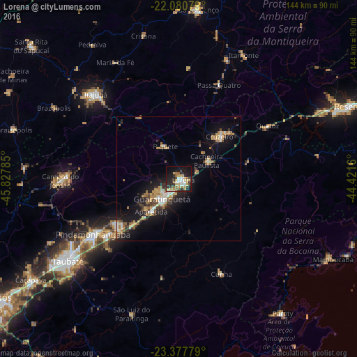

Analysis of Lorena night lights 2016
Square area 10x10 km:
 5.36%
5.36%90-99
5.75%80-89
7.14%70-79
8.53%60-69
3.37%50-59
5.56%40-49
2.38%30-39
6.35%20-29
16.27%10-19
26.79%0-9
12.5%Square area 50x50 km:
0.93%90-99
1.3%80-89
1.1%70-79
1.58%60-69
1.62%50-59
1.42%40-49
0.93%30-39
1.31%20-29
2.67%10-19
8.14%0-9
78.99%Clear (daylight) street map image can be seen on geolist.org.
Map coordinates:
22° 4' 50.8" South, 45° 49' 40.3" West
22° 43' 51" South, 45° 7' 29" West
23° 22' 40" South, 44° 25' 17.8" West
Some cities around Lorena sort by population:
• Pindamonhangaba
40.7 km =25.3 mi,  238°
238°
• Guaratinguetá
11.8 km =7.3 mi,  216°
216°
• Itajubá
47.8 km =29.7 mi,  315°
315°
• Cruzeiro
23.6 km =14.7 mi,  41°
41°
• Aparecida
16.8 km =10.4 mi, 219°
• Piquete
14.1 km =8.8 mi,  337°
337°
• Passa Quatro
41.2 km =25.6 mi,  23°
23°
• Cunha
41.8 km =26 mi,  156°
156°
3458425 (p: 76,506)
Sources (retrieved 2019-11-25):
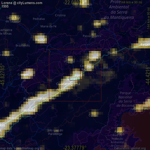
» NASA, Earths city lights 1995
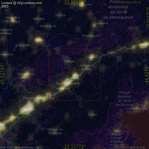
» NASA city lights 2003
» Earth at Night: Flat Maps 2012, 2016