Cunha night lights from space
Night Light of Cunha (São Paulo) from space (Brazil) Src. Average luminocity for 10x10km area is 5.4754% and for 50x50km: 0.9233%.
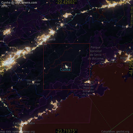
Analysis of Cunha night lights 2016
Square area 10x10 km:
 0.57%
0.57%90-99
0.19%80-89
2.08%70-79
1.52%60-69
0.95%50-59
0%40-49
0.76%30-39
0%20-29
0%10-19
0%0-9
93.94%Square area 50x50 km:
0.08%90-99
0.06%80-89
0.19%70-79
0.13%60-69
0.16%50-59
0.09%40-49
0.13%30-39
0.04%20-29
0.21%10-19
0.51%0-9
98.4%Clear (daylight) street map image can be seen on geolist.org.
Map coordinates:
22° 25' 33.7" South, 45° 39' 46.3" West
23° 4' 28" South, 44° 57' 35" West
23° 43' 11.1" South, 44° 15' 23.8" West
Some cities around Cunha sort by population:
• Pindamonhangaba
54 km =33.6 mi,  288°
288°
• Guaratinguetá
37.3 km =23.2 mi,  320°
320°
• Ubatuba
41.6 km =25.8 mi,  195°
195°
• Lorena
41.8 km =26 mi,  336°
336°
• Cruzeiro
55.7 km =34.6 mi,  358°
358°
• Aparecida
37.5 km =23.3 mi,  312°
312°
• Paraty
29.8 km =18.5 mi,  122°
122°
• Piquete
55.8 km =34.7 mi, 336°
3465010 (p: 11,895)
Sources (retrieved 2019-11-25):
» Earth at Night: Flat Maps 2012, 2016