Palmeiras de Goiás night lights from space
Night Light of Palmeiras de Goiás (Goiás) from space (Brazil) Src. Average luminocity for 10x10km area is 17.8377% and for 50x50km: 1.4631%.
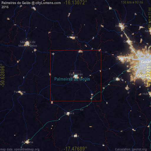
Analysis of Palmeiras de Goiás night lights 2016
Square area 10x10 km:
 0.87%
0.87%90-99
4.33%80-89
1.95%70-79
4.76%60-69
2.81%50-59
1.08%40-49
1.73%30-39
0.65%20-29
0%10-19
2.81%0-9
79%Square area 50x50 km:
0.06%90-99
0.18%80-89
0.08%70-79
0.52%60-69
0.24%50-59
0.18%40-49
0.31%30-39
0.17%20-29
0.11%10-19
0.14%0-9
98.02%Clear (daylight) street map image can be seen on geolist.org.
Map coordinates:
16° 7' 50.6" South, 50° 37' 44.3" West
16° 48' 18" South, 49° 55' 33" West
17° 28' 36.8" South, 49° 13' 21.8" West
Some cities around Palmeiras de Goiás sort by population:
• Trindade
49.6 km =30.8 mi,  69°
69°
• São Luís de Montes Belos
56.8 km =35.3 mi,  303°
303°
• Goianira
63.3 km =39.3 mi,  57°
57°
• Anicuns
38.4 km =23.9 mi,  354°
354°
• Guapó
42 km =26.1 mi,  93°
93°
• Edéia
59.3 km =36.8 mi,  180°
180°
• Paraúna
57.8 km =35.9 mi,  254°
254°
• Firminópolis
47.4 km =29.5 mi, 301°
3455362 (p: 13,572)
Sources (retrieved 2019-11-25):
» Earth at Night: Flat Maps 2012, 2016