Barro Alto night lights from space
Night Light of Barro Alto (Goiás) from space (Brazil) Src. Average luminocity for 10x10km area is 4.4607% and for 50x50km: 0.5204%.
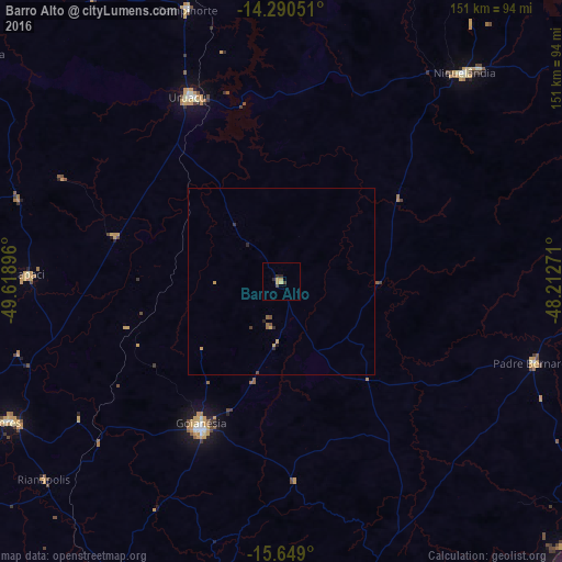
Analysis of Barro Alto night lights 2016
Square area 10x10 km:
 0%
0%90-99
0%80-89
1.24%70-79
2.07%60-69
0%50-59
0%40-49
1.45%30-39
0.62%20-29
2.07%10-19
0%0-9
92.56%Square area 50x50 km:
0%90-99
0%80-89
0.05%70-79
0.25%60-69
0.02%50-59
0.07%40-49
0.16%30-39
0.11%20-29
0.21%10-19
0.02%0-9
99.11%Clear (daylight) street map image can be seen on geolist.org.
Map coordinates:
14° 17' 25.8" South, 49° 37' 8.3" West
14° 58' 15" South, 48° 54' 57" West
15° 38' 56.4" South, 48° 12' 45.8" West
Some cities around Barro Alto sort by population:
• Goianésia
44.2 km =27.5 mi,  209°
209°
• Uruaçu
55.2 km =34.3 mi,  333°
333°
• Niquelândia
73.9 km =45.9 mi,  41°
41°
• Ceres
82.3 km =51.1 mi,  242°
242°
• Padre Bernardo
71.3 km =44.3 mi,  107°
107°
• Itapaci
68.1 km =42.3 mi,  271°
271°
• Rialma
81.3 km =50.5 mi, 241°
• Carmo do Rio Verde
95 km =59 mi, 243°
3470409 (p: 7,633)
Sources (retrieved 2019-11-25):
» Earth at Night: Flat Maps 2012, 2016