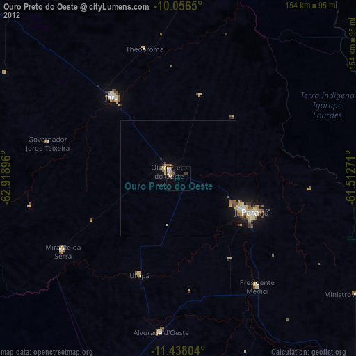
Ouro Preto do Oeste night lights from space
Night Light of Ouro Preto do Oeste (Rondônia) from space (Brazil) Src. Average luminocity for 10x10km area is 15.5888% and for 50x50km: 1.7192%.
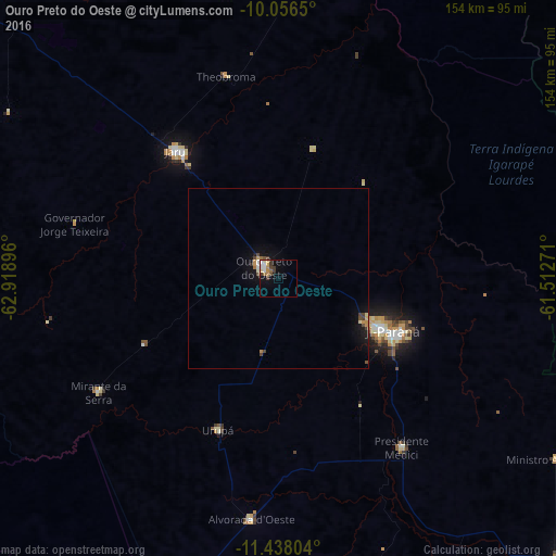
Analysis of Ouro Preto do Oeste night lights 2016
Square area 10x10 km:
 2.48%
2.48%90-99
2.48%80-89
3.1%70-79
1.86%60-69
2.48%50-59
0%40-49
2.27%30-39
4.34%20-29
0%10-19
6.61%0-9
74.38%Square area 50x50 km:
0.14%90-99
0.19%80-89
0.23%70-79
0.24%60-69
0.24%50-59
0.04%40-49
0.39%30-39
0.31%20-29
0.1%10-19
1.59%0-9
96.52%Clear (daylight) street map image can be seen on geolist.org.
Map coordinates:
10° 3' 23.4" South, 62° 55' 8.3" West
10° 44' 53" South, 62° 12' 57" West
11° 26' 16.9" South, 61° 30' 45.8" West
Some cities around Ouro Preto do Oeste sort by population:
• Ji Paraná
32.6 km =20.3 mi,  117°
117°
• Ariquemes
129.5 km =80.5 mi,  315°
315°
• Cacoal
113.7 km =70.6 mi,  132°
132°
• Pôsto Fiscal Rolim de Moura
259.7 km =161.4 mi,  181°
181°
• Jaru
44 km =27.3 mi, 321°
• Aripuanã
246.9 km =153.4 mi,  44°
44°
• Pimenta Bueno
151.6 km =94.2 mi, 132°
• Presidente Médici
58.6 km =36.4 mi,  144°
144°
3924948 (p: 26,683)
Sources (retrieved 2019-11-25):
» Earth at Night: Flat Maps 2012, 2016