Ariquemes night lights from space
Night Light of Ariquemes (Rondônia) from space (Brazil) Src. Average luminocity for 10x10km area is 50.0021% and for 50x50km: 2.7324%.
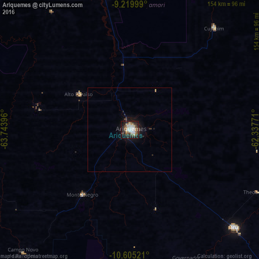

Analysis of Ariquemes night lights 2016
Square area 10x10 km:
 11.16%
90-99
10.33%80-89
4.96%70-79
4.34%60-69
7.02%50-59
3.93%40-49
11.36%30-39
7.23%20-29
12.81%10-19
23.97%0-9
2.89%Square area 50x50 km:
0.45%90-99
0.42%80-89
0.24%70-79
0.21%60-69
0.29%50-59
0.17%40-49
0.57%30-39
0.54%20-29
0.69%10-19
2.49%0-9
93.93%Clear (daylight) street map image can be seen on geolist.org.
Map coordinates:
9° 13' 12" South, 63° 44' 38.3" West
9° 54' 48" South, 63° 2' 27" West
10° 36' 18.8" South, 62° 20' 15.8" West
Some cities around Ariquemes sort by population:
• Porto Velho
159.2 km =98.9 mi,  323°
323°
• Ji Paraná
160.8 km =99.9 mi,  132°
132°
• Cacoal
243.1 km =151.1 mi, 134°
• Guajará Mirim
269 km =167.1 mi,  248°
248°
• Humaitá
266.5 km =165.6 mi,  0°
0°
• Jaru
85.8 km =53.3 mi, 132°
• Ouro Preto do Oeste
129.5 km =80.5 mi,  135°
135°
• Presidente Médici
187.6 km =116.6 mi, 138°
3665199 (p: 58,096)
Sources (retrieved 2019-11-25):
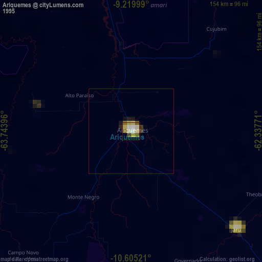
» NASA, Earths city lights 1995
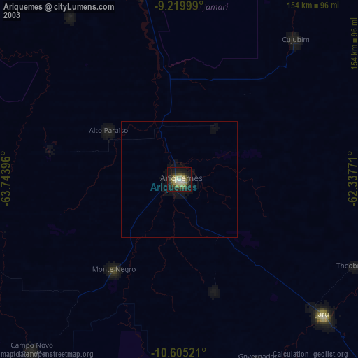
» NASA city lights 2003
» Earth at Night: Flat Maps 2012, 2016