Montanha night lights from space
Night Light of Montanha (Espírito Santo) from space (Brazil) Src. Average luminocity for 10x10km area is 10.5216% and for 50x50km: 1.4864%.
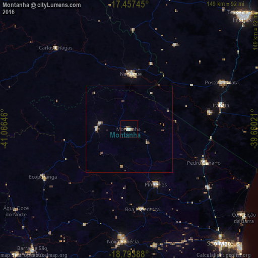
Analysis of Montanha night lights 2016
Square area 10x10 km:
 1.52%
1.52%90-99
1.95%80-89
1.73%70-79
1.52%60-69
0.22%50-59
0.87%40-49
2.16%30-39
2.16%20-29
0%10-19
0.87%0-9
87.01%Square area 50x50 km:
0.14%90-99
0.12%80-89
0.42%70-79
0.06%60-69
0.1%50-59
0.22%40-49
0.39%30-39
0.43%20-29
0.13%10-19
0.07%0-9
97.92%Clear (daylight) street map image can be seen on geolist.org.
Map coordinates:
17° 27' 26.8" South, 41° 3' 59.3" West
18° 7' 37" South, 40° 21' 48" West
18° 47' 38" South, 39° 39' 36.8" West
Some cities around Montanha sort by population:
• Nanuque
32 km =19.9 mi,  1°
1°
• Nova Venécia
65 km =40.4 mi,  183°
183°
• Posto da Mata
59.9 km =37.2 mi,  63°
63°
• Conceição da Barra
84.4 km =52.4 mi,  127°
127°
• Ecoporanga
56.4 km =35 mi,  240°
240°
• Carlos Chagas
63.6 km =39.5 mi,  317°
317°
• Mucurici
16.5 km =10.3 mi,  283°
283°
• Boa Esperança
46.5 km =28.9 mi,  171°
171°
3456905 (p: 11,934)
Sources (retrieved 2019-11-25):
» Earth at Night: Flat Maps 2012, 2016