Boa Esperança night lights from space
Night Light of Boa Esperança (Espírito Santo) from space (Brazil) Src. Average luminocity for 10x10km area is 9.2438% and for 50x50km: 4.1445%.
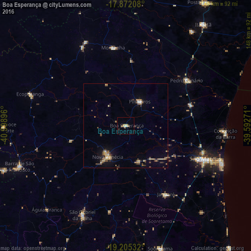
Analysis of Boa Esperança night lights 2016
Square area 10x10 km:
 1.24%
1.24%90-99
0.41%80-89
3.72%70-79
0.41%60-69
2.48%50-59
0%40-49
0.83%30-39
0.21%20-29
0.62%10-19
0%0-9
90.08%Square area 50x50 km:
0.21%90-99
0.16%80-89
1.07%70-79
0.51%60-69
0.54%50-59
0.57%40-49
1.03%30-39
0.67%20-29
0.49%10-19
1.49%0-9
93.24%Clear (daylight) street map image can be seen on geolist.org.
Map coordinates:
17° 52' 19.5" South, 40° 59' 56.3" West
18° 32' 24" South, 40° 17' 45" West
19° 12' 19.2" South, 39° 35' 33.8" West
Some cities around Boa Esperança sort by population:
• São Mateus
50.2 km =31.2 mi,  113°
113°
• Nanuque
78.2 km =48.6 mi,  355°
355°
• Nova Venécia
21.9 km =13.6 mi,  210°
210°
• Barra de São Francisco
67.1 km =41.7 mi,  249°
249°
• Conceição da Barra
59.7 km =37.1 mi,  95°
95°
• Ecoporanga
59.4 km =36.9 mi,  288°
288°
• Montanha
46.5 km =28.9 mi,  351°
351°
• Mucurici
54.8 km =34.1 mi,  334°
334°
3469942 (p: 9,254)
Sources (retrieved 2019-11-25):
» Earth at Night: Flat Maps 2012, 2016