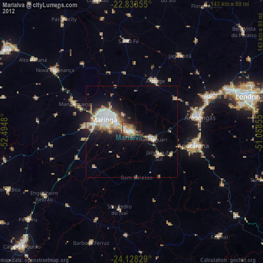
Marialva night lights from space
Night Light of Marialva (Paraná) from space (Brazil) Src. Average luminocity for 10x10km area is 43.1686% and for 50x50km: 14.9452%.
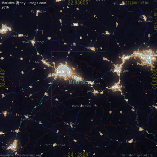
Analysis of Marialva night lights 2016
Square area 10x10 km:
 6.82%
6.82%90-99
5.3%80-89
3.03%70-79
8.71%60-69
6.44%50-59
5.87%40-49
9.85%30-39
10.61%20-29
11.17%10-19
27.08%0-9
5.11%Square area 50x50 km:
3.2%90-99
2.93%80-89
1.04%70-79
2.13%60-69
1.88%50-59
1.19%40-49
2.39%30-39
1.8%20-29
3.59%10-19
7.37%0-9
72.47%Clear (daylight) street map image can be seen on geolist.org.
Map coordinates:
22° 50' 18.8" South, 52° 29' 41.3" West
23° 29' 6" South, 51° 47' 30" West
24° 7' 41.8" South, 51° 5' 18.8" West
Some cities around Marialva sort by population:
• Maringá
16.4 km =10.2 mi,  293°
293°
• Apucarana
34.5 km =21.4 mi,  102°
102°
• Sarandi
9.6 km =6 mi,  298°
298°
• Mandaguari
14.1 km =8.8 mi,  119°
119°
• Paiçandu
26.4 km =16.4 mi,  276°
276°
• Astorga
30.9 km =19.2 mi,  24°
24°
• Jandaia do Sul
20 km =12.4 mi,  130°
130°
• Mandaguaçu
34.6 km =21.5 mi, 296°
3457741 (p: 26,000)
Sources (retrieved 2019-11-25):
» Earth at Night: Flat Maps 2012, 2016