Jandaia do Sul night lights from space
Night Light of Jandaia do Sul (Paraná) from space (Brazil) Src. Average luminocity for 10x10km area is 18.0536% and for 50x50km: 11.8894%.
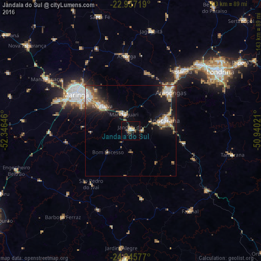
Analysis of Jandaia do Sul night lights 2016
Square area 10x10 km:
 2.58%
2.58%90-99
1.39%80-89
1.79%70-79
2.18%60-69
2.38%50-59
1.19%40-49
4.56%30-39
2.18%20-29
1.19%10-19
20.04%0-9
60.52%Square area 50x50 km:
1.91%90-99
1.77%80-89
0.95%70-79
1.82%60-69
2.01%50-59
1.28%40-49
1.81%30-39
1.65%20-29
2.54%10-19
8.97%0-9
75.29%Clear (daylight) street map image can be seen on geolist.org.
Map coordinates:
22° 57' 25.9" South, 52° 20' 47.3" West
23° 36' 11" South, 51° 38' 36" West
24° 14' 44.8" South, 50° 56' 24.8" West
Some cities around Jandaia do Sul sort by population:
• Maringá
36 km =22.4 mi,  303°
303°
• Apucarana
19.5 km =12.1 mi,  72°
72°
• Arapongas
30.2 km =18.8 mi,  47°
47°
• Sarandi
29.4 km =18.3 mi,  307°
307°
• Rolândia
43 km =26.7 mi,  40°
40°
• Mandaguari
6.8 km =4.2 mi,  335°
335°
• Marialva
20 km =12.4 mi, 310°
• Astorga
41.3 km =25.7 mi,  356°
356°
3460172 (p: 17,507)
Sources (retrieved 2019-11-25):
» Earth at Night: Flat Maps 2012, 2016