Mâncio Lima night lights from space
Night Light of Mâncio Lima (Acre) from space (Brazil) Src. Average luminocity for 10x10km area is 12.4502% and for 50x50km: 2.4025%.
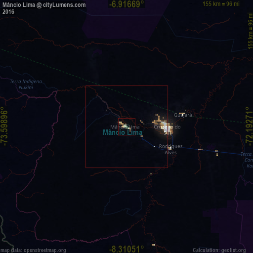
Analysis of Mâncio Lima night lights 2016
Square area 10x10 km:
 0%
0%90-99
2.6%80-89
3.9%70-79
1.3%60-69
0.87%50-59
0%40-49
3.9%30-39
2.16%20-29
2.16%10-19
0.22%0-9
82.9%Square area 50x50 km:
0.21%90-99
0.5%80-89
0.41%70-79
0.2%60-69
0.16%50-59
0.35%40-49
0.43%30-39
0.23%20-29
0.46%10-19
1.72%0-9
95.34%Clear (daylight) street map image can be seen on geolist.org.
Map coordinates:
6° 55' 0.1" South, 73° 35' 56.3" West
7° 36' 51" South, 72° 53' 45" West
8° 18' 37.8" South, 72° 11' 33.8" West
Some cities around Mâncio Lima sort by population:
• Pucallpa, PE
201.4 km =125.1 mi,  245°
245°
• Cruzeiro do Sul
24.1 km =15 mi,  93°
93°
• Eirunepé
349.9 km =217.4 mi,  72°
72°
• Tarauacá
242.4 km =150.6 mi,  104°
104°
• Contamana, PE
235.9 km =146.6 mi,  277°
277°
• Feijó
286.5 km =178 mi, 102°
• Envira
297.4 km =184.8 mi,  83°
83°
• Campoverde, PE
231.2 km =143.7 mi, 245°
3663516 (p: 7,086)
Sources (retrieved 2019-11-25):
» Earth at Night: Flat Maps 2012, 2016